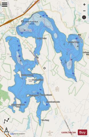
Massabesic Lake fishing map is available as part of iBoating : USA Marine & Fishing App(now supported on multiple platforms including Android, iPhone/iPad, MacBook, and Windows(tablet and phone)/PC based chartplotter.).
With our Lake Maps App, you get all the great marine chart app features like fishing spots, along with Massabesic Lake depth map. The fishing maps app include HD lake depth contours, along with advanced features found in Fish Finder / Gps Chart Plotter systems, turning your device into a Depth Finder. The Massabesic Lake Navigation App provides advanced features of a Marine Chartplotter including adjusting water level offset and custom depth shading. Fishing spots and depth contours layers are available in most Lake maps. Lake navigation features include advanced instrumentation to gather wind speed direction, water temperature, water depth, and accurate GPS with AIS receivers(using NMEA over TCP/UDP). Autopilot support can be enabled during ‘Goto WayPoint’ and ‘Route Assistance’.
Now i-Boating supports Fishing Points in Massabesic Lake.
Have more questions about the Nautical Chart App? Ask us.
Fishing Info for Massabesic Lake
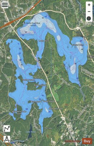
Lake Massabesic or Massabesic Lake is a lake in southern New Hampshire, United States, covering about 2,560 acres (1,040 ha) (equivalent to about 4 sq mi or 10 km2) within the city of Manchester and the town of Auburn. Because it provides drinking water for Manchester, swimming and water skiing are not allowed there. Popular sports on the lake are sailing, fishing, and kayaking. The recreational trails along the lake provide views of the lake and the town of Auburn. Besides flowing into the Manchester water system, the lake's water feeds Cohas Brook, leading to the Merrimack River. Massabesic is a Native American name meaning "place of much water" or "near the great brook." The lake is classified as a cold- and warmwater fishery.
More on Wikipedia...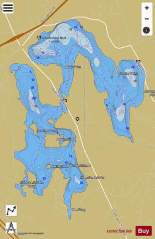
Massabesic Lake Fishing Map Stats | |
| Title | Massabesic Lake |
| Scale | 1:6000 |
| Counties | Hillsborough, Rockingham |
| Nearby Cities | Auburn, South Hooksett, Manchester, Derry, Londonderry, Chester, Candia, Pinardville, Hooksett, Bedford |
| Area * | 2560.58 acres |
| Shoreline * | 31.46 miles |
| Min Longitude | -71.40 |
| Min Latitude | 42.95 |
| Max Longitude | -71.34 |
| Max Latitude | 43.01 |
| Edition Label 1 | |
| Edition Label 2 | |
| Edition Label 3 | |
| Id | US_NH_00868302 |
| Country | US |
| Projection | Mercator |
| * some Stats may include nearby/connecting waterbodies | |
|