Marine Navigation app for USA for Android/iPhone/Blackberry/Windows®
This app supports has all NOAA RNC charts, USACE Inland River Charts, US lake bathymetric maps, fishing charts, and several US reservoirs. Each marine chart comes with vector POI layers that includes Buoys, Lights, Obstructions, boat ramps.
You can browse charts by
- Marine Charts by State
- NOAA Marine Charts by Regions
- NOAA Marine Charts by Coast Guard District
- Inland Rivers (USACE)
|
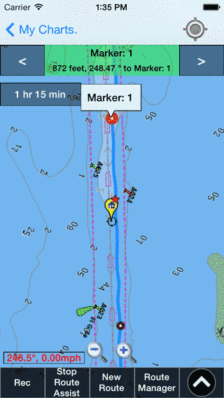
You can download all your favorite marine charts for offline use straight to your device. Use Auto Follow feature to view your Boat location on marine chart. View/Search preloaded POIs (Point of Interests) on nautical chart to help orient yourself. You can also create Custom Waypoints to route yourself. Start GPS recording, and Gps Nautical Charts app will keep track of your route. Export GPS tracks to SDCard for use with popular mapping software like Google Earth. Once marine chart maps are downloaded to your phone, no Cellphone Connectivity is required. View all the marine charts app features here. Want to see it in action? You can watch video of our marine navigation app here?
You can purchase Nautical Charts here. Have more questions about the App, or cannot find the chart you are looking for? Ask us. |
 |