Nahwatzel Lake fishing map is available as part of iBoating : USA Marine & Fishing App(now supported on multiple platforms including Android, iPhone/iPad, MacBook, and Windows(tablet and phone)/PC based chartplotter.).
With our Lake Maps App, you get all the great marine chart app features like fishing spots, along with Nahwatzel Lake depth map. The fishing maps app include HD lake depth contours, along with advanced features found in Fish Finder / Gps Chart Plotter systems, turning your device into a Depth Finder. The Nahwatzel Lake Navigation App provides advanced features of a Marine Chartplotter including adjusting water level offset and custom depth shading. Fishing spots and depth contours layers are available in most Lake maps. Lake navigation features include advanced instrumentation to gather wind speed direction, water temperature, water depth, and accurate GPS with AIS receivers(using NMEA over TCP/UDP). Autopilot support can be enabled during ‘Goto WayPoint’ and ‘Route Assistance’.
Now i-Boating supports Fishing Points in Nahwatzel Lake.
Have more questions about the Nautical Chart App? Ask us.
Fishing Info for Nahwatzel Lake
Lake Nahwatzel is a body of freshwater located in Mason County in the U.S. state of Washington. The lake is fed by three main sources, which include two unnamed creeks and naturally occurring hot springs. The lake empties into the East Fork of the Satsop River via Outlet Creek. Lake Nahwatzel is one of the warmest lakes in western Washington due to the presence of the aforementioned hot springs. Nearby towns include Shelton and Matlock. Lake Nahwatzel has a surface area of 269 acres (109 ha) and a maximum depth of 25 feet (7.6 m).
More on Wikipedia...Popular fish species in this lake include Rainbow trout.
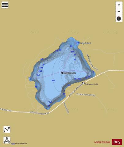
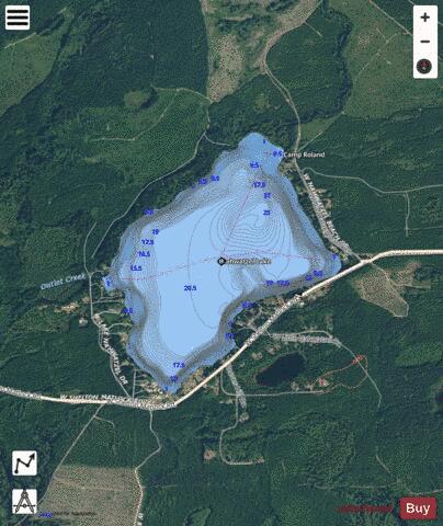
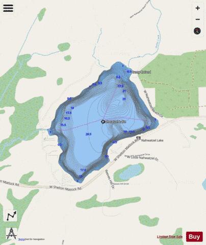
Nahwatzel Lake Fishing Map Stats | |
| Title | Nahwatzel Lake |
| Scale | 1:12000 |
| Counties | Mason |
| Nearby Cities | Matlock, Skokomish, McCleary, Shelton, Elma, Hoodsport, Union, Satsop, Malone, Grisdale |
| Area * | 280.20 acres |
| Shoreline * | 3.00 miles |
| Min Longitude | -123.34 |
| Min Latitude | 47.24 |
| Max Longitude | -123.32 |
| Max Latitude | 47.25 |
| Edition Label 1 | |
| Edition Label 2 | |
| Edition Label 3 | |
| Id | US_WA_01523561 |
| Country | US |
| Projection | Mercator |
| * some Stats may include nearby/connecting waterbodies | |
|