Fourmile Lake fishing map is available as part of iBoating : USA Marine & Fishing App(now supported on multiple platforms including Android, iPhone/iPad, MacBook, and Windows(tablet and phone)/PC based chartplotter.).
With our Lake Maps App, you get all the great marine chart app features like fishing spots, along with Fourmile Lake depth map. The fishing maps app include HD lake depth contours, along with advanced features found in Fish Finder / Gps Chart Plotter systems, turning your device into a Depth Finder. The Fourmile Lake Navigation App provides advanced features of a Marine Chartplotter including adjusting water level offset and custom depth shading. Fishing spots and depth contours layers are available in most Lake maps. Lake navigation features include advanced instrumentation to gather wind speed direction, water temperature, water depth, and accurate GPS with AIS receivers(using NMEA over TCP/UDP). Autopilot support can be enabled during ‘Goto WayPoint’ and ‘Route Assistance’.
Now i-Boating supports Fishing Points in Fourmile Lake.
Have more questions about the Nautical Chart App? Ask us.
Fishing Info for Fourmile Lake
Fourmile Lake (or Four Mile Lake) is a reservoir located 5,748 feet (1,752 m) above sea level in Klamath County, Oregon, United States. It is 45 miles (72 km) northeast of Medford.The lake was created when the 25-foot (7.6 m) tall Fourmile Lake Dam was constructed, impounding Fourmile Creek, in the Klamath River watershed. It is located just to the east of Mount McLoughlin, which stands 9,495 feet (2,894 m) above sea level. The lake is bordered by Sky Lakes Wilderness, and is in the Winema National Forest.
More on Wikipedia...Popular fish species in this lake include Lake trout.
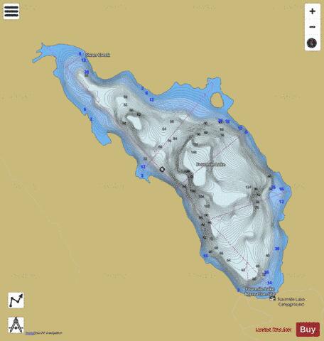
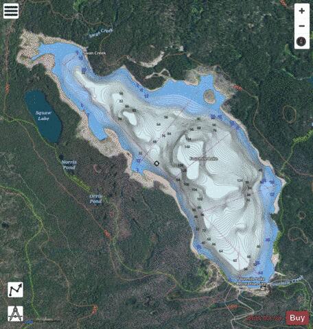
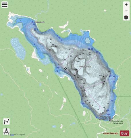
Fourmile Lake Fishing Map Stats | |
| Title | Fourmile Lake |
| Scale | 1:6000 |
| Counties | Klamath |
| Nearby Cities | Butte Falls, Fort Klamath, Klamath Agency, Prospect, Lake Creek, Chiloquin, Keno, Union Creek, Kirk, Klamath Falls |
| Area * | 625.68 acres |
| Shoreline * | 6.47 miles |
| Min Longitude | -122.27 |
| Min Latitude | 42.45 |
| Max Longitude | -122.24 |
| Max Latitude | 42.48 |
| Edition Label 1 | |
| Edition Label 2 | |
| Edition Label 3 | |
| Id | US_OR_ordfw_fourmile_lake |
| Country | US |
| Projection | Mercator |
| * some Stats may include nearby/connecting waterbodies | |
|