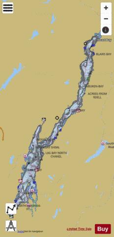
Lake George fishing map is available as part of iBoating : USA Marine & Fishing App(now supported on multiple platforms including Android, iPhone/iPad, MacBook, and Windows(tablet and phone)/PC based chartplotter.).
With our Lake Maps App, you get all the great marine chart app features like fishing spots, along with Lake George depth map. The fishing maps app include HD lake depth contours, along with advanced features found in Fish Finder / Gps Chart Plotter systems, turning your device into a Depth Finder. The Lake George Navigation App provides advanced features of a Marine Chartplotter including adjusting water level offset and custom depth shading. Fishing spots and depth contours layers are available in most Lake maps. Lake navigation features include advanced instrumentation to gather wind speed direction, water temperature, water depth, and accurate GPS with AIS receivers(using NMEA over TCP/UDP). Autopilot support can be enabled during ‘Goto WayPoint’ and ‘Route Assistance’.
Now i-Boating supports Fishing Points in Lake George.
Have more questions about the Nautical Chart App? Ask us.
Fishing Info for Lake George
Lake George (Mohawk: Kaniá:taro’kte), nicknamed the Queen of American Lakes, is a long, narrow oligotrophic lake located at the southeast base of the Adirondack Mountains, in the northeastern portion of the U.S. state of New York. It lies within the upper region of the Great Appalachian Valley and drains all the way northward into Lake Champlain and the St. Lawrence River drainage basin. The lake is situated along the historical natural (Amerindian) path between the valleys of the Hudson and St. Lawrence Rivers, and so lies on the direct land route between Albany, New York, and Montreal, Quebec, Canada. The lake extends about 32.2 mi (51.8 km) on a north–south axis, is 187 ft (57 m) deep, and ranges from one to three miles (1.6 to 4.8 km) in width, presenting a significant barrier to east–west travel. Although the year-round population of the Lake George region is relatively small, the summertime population can swell to over 50,000 residents, many in the village of Lake George region at the southern end of the lake. Lake George drains into Lake Champlain to its north through a short stream, the La Chute River, with many falls and rapids, dropping 226 feet (69 m) in its 3.5-mile (5.6 km) course—virtually all of which is within the lands of Ticonderoga, New York, and near the site of Fort Ticonderoga. Ultimately the waters flowing via the 106-mile-long (171 km) Richelieu River drain into the St. Lawrence River downstream and northeast of Montreal, and then into the North Atlantic Ocean Nova Scotia.
More on Wikipedia...Lake George Fishing Map Stats | |
| Title | Lake George |
| Sailing Clubs in this Chart region | |
| Northern Lake George Yacht Club | |
| The Lake George Club | |
| Scale | 1:12000 |
| Counties | Essex, Warren, Washington |
| Nearby Cities | Hague, Lake George, Bolton Landing, Bolton, Ticonderoga, Putnam, Dresden, Queensbury, Warrensburg, Crown Point |
| Area * | 28536.71 acres |
| Shoreline * | 162.33 miles |
| Min Longitude | -73.71 |
| Min Latitude | 43.42 |
| Max Longitude | -73.42 |
| Max Latitude | 43.84 |
| Edition Label 1 | |
| Edition Label 2 | |
| Edition Label 3 | |
| Id | US_NY_1006_0016 |
| Country | US |
| Projection | Mercator |
| * some Stats may include nearby/connecting waterbodies | |
|


