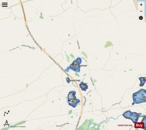
Great Pond fishing map is available as part of iBoating : USA Marine & Fishing App(now supported on multiple platforms including Android, iPhone/iPad, MacBook, and Windows(tablet and phone)/PC based chartplotter.).
With our Lake Maps App, you get all the great marine chart app features like fishing spots, along with Great Pond depth map. The fishing maps app include HD lake depth contours, along with advanced features found in Fish Finder / Gps Chart Plotter systems, turning your device into a Depth Finder. The Great Pond Navigation App provides advanced features of a Marine Chartplotter including adjusting water level offset and custom depth shading. Fishing spots and depth contours layers are available in most Lake maps. Lake navigation features include advanced instrumentation to gather wind speed direction, water temperature, water depth, and accurate GPS with AIS receivers(using NMEA over TCP/UDP). Autopilot support can be enabled during ‘Goto WayPoint’ and ‘Route Assistance’.
Now i-Boating supports Fishing Points in Great Pond.
Have more questions about the Nautical Chart App? Ask us.
Fishing Info for Great Pond
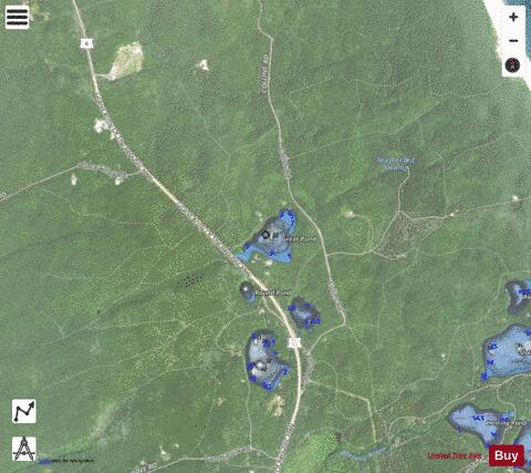
Great Pond (Truro) is one of three ponds in Barnstable County that share the name. The others are located in Eastham and Provincetown. Great Pond in Truro is 17-acre natural kettle pond with an average depth of 14 feet (4.3 m) and a maximum depth of 35 feet (11 m). Transparency is very good, extending to 14 feet (4.3 m), and aquatic vegetation is scarce. The bottom is composed primarily of sand. The shoreline is lightly developed with residential homes. Great Pond is located just east of Route 6 within the Cape Cod National Seashore. Access is through an unmarked dirt road off Route 6, 0.7 miles (1.1 km) north of the Truro/Wellfleet line just beyond Savage Rd. Anglers must park along the shoulder of Route 6 and walk in. A steep dirt path leads to a shallow cove at the eastern end of the pond. Access is suitable only for wading anglers, canoes and lightweight cartop boats. Great Pond is generally quite acidic. It has been limed in the past. The state used to stock the pond with smallmouth bass and trout, but was not stocking it in 2018.
More on Wikipedia...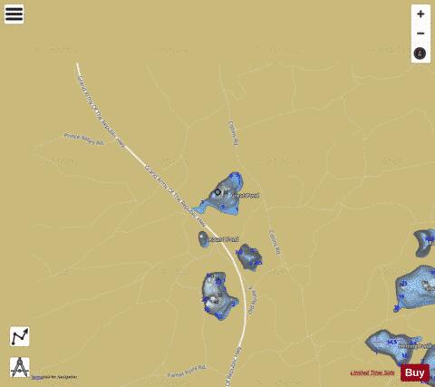
Great Pond Fishing Map Stats | |
| Title | Great Pond |
| Scale | 1:3000 |
| Counties | Barnstable |
| Nearby Cities | Truro, Wellfleet, North Truro, North Eastham, Eastham, Provincetown, Orleans, Brewster, East Dennis, East Harwich |
| Area * | 17.63 acres |
| Shoreline * | 0.84 miles |
| Min Longitude | -70.03 |
| Min Latitude | 41.97 |
| Max Longitude | -70.03 |
| Max Latitude | 41.98 |
| Edition Label 1 | |
| Edition Label 2 | |
| Edition Label 3 | |
| Id | US_LM_us_ma_ba_tr_great |
| Country | US |
| Projection | Mercator |
| * some Stats may include nearby/connecting waterbodies | |
|