Walden Pond fishing map is available as part of iBoating : USA Marine & Fishing App(now supported on multiple platforms including Android, iPhone/iPad, MacBook, and Windows(tablet and phone)/PC based chartplotter.).
With our Lake Maps App, you get all the great marine chart app features like fishing spots, along with Walden Pond depth map. The fishing maps app include HD lake depth contours, along with advanced features found in Fish Finder / Gps Chart Plotter systems, turning your device into a Depth Finder. The Walden Pond Navigation App provides advanced features of a Marine Chartplotter including adjusting water level offset and custom depth shading. Fishing spots and depth contours layers are available in most Lake maps. Lake navigation features include advanced instrumentation to gather wind speed direction, water temperature, water depth, and accurate GPS with AIS receivers(using NMEA over TCP/UDP). Autopilot support can be enabled during ‘Goto WayPoint’ and ‘Route Assistance’.
Now i-Boating supports Fishing Points in Walden Pond.
Have more questions about the Nautical Chart App? Ask us.
Fishing Info for Walden Pond
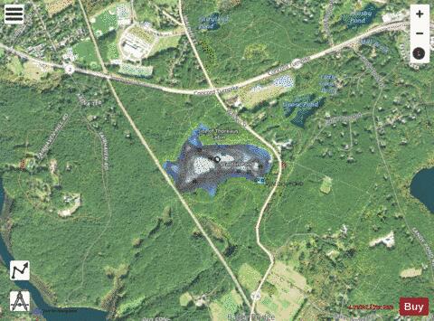
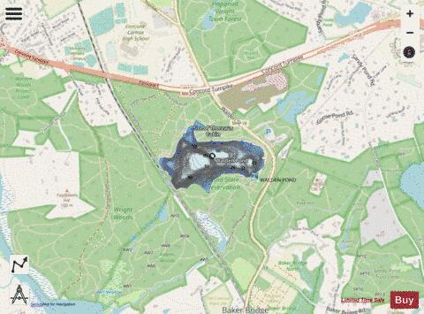
Walden Pond is a pond in Concord, Massachusetts, in the United States. A famous example of a kettle hole, it was formed by retreating glaciers 10,000–12,000 years ago. The pond is protected as part of Walden Pond State Reservation, a 335-acre (136 ha) state park and recreation site managed by the Massachusetts Department of Conservation and Recreation. The reservation was designated a National Historic Landmark in 1962 for its association with the writer Henry David Thoreau (1817–1862), whose two years living in a cabin on its shore provided the foundation for his famous 1854 work, Walden; or, Life in the Woods. The National Historic Preservation Act of 1966 ensured federal support for the preservation of the pond.
More on Wikipedia...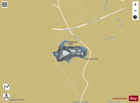
Walden Pond Fishing Map Stats | |
| Title | Walden Pond |
| Scale | 1:3000 |
| Counties | Middlesex |
| Nearby Cities | Concord, Lincoln, West Concord, North Sudbury, Wayland, Bedford, Weston, Carlisle, Sudbury, Acton |
| Area * | 62.94 acres |
| Shoreline * | 1.77 miles |
| Min Longitude | -71.35 |
| Min Latitude | 42.44 |
| Max Longitude | -71.33 |
| Max Latitude | 42.44 |
| Edition Label 1 | |
| Edition Label 2 | |
| Edition Label 3 | |
| Id | US_CC_MA_00611885 |
| Country | US |
| Projection | Mercator |
| * some Stats may include nearby/connecting waterbodies | |
|