Little Muskego Lake fishing map is available as part of iBoating : USA Marine & Fishing App(now supported on multiple platforms including Android, iPhone/iPad, MacBook, and Windows(tablet and phone)/PC based chartplotter.).
With our Lake Maps App, you get all the great marine chart app features like fishing spots, along with Little Muskego Lake depth map. The fishing maps app include HD lake depth contours, along with advanced features found in Fish Finder / Gps Chart Plotter systems, turning your device into a Depth Finder. The Little Muskego Lake Navigation App provides advanced features of a Marine Chartplotter including adjusting water level offset and custom depth shading. Fishing spots and depth contours layers are available in most Lake maps. Lake navigation features include advanced instrumentation to gather wind speed direction, water temperature, water depth, and accurate GPS with AIS receivers(using NMEA over TCP/UDP). Autopilot support can be enabled during ‘Goto WayPoint’ and ‘Route Assistance’.
Now i-Boating supports Fishing Points in Little Muskego Lake.
Have more questions about the Nautical Chart App? Ask us.
Fishing Info for Little Muskego Lake
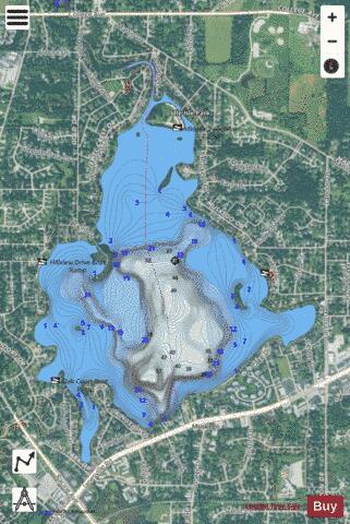
Little Muskego Lake is located in Muskego, Waukesha County, Wisconsin, along a tributary of the Fox River. It is populated by musk grass, water celery, and several invasive plant species. Fishing is permitted for personal consumption only. Bass and panfish are most commonly caught. It hosts many recreational activities, including boating, swimming, waterskiing, and ice fishing. Its mean depth is 14 meters (46 ft) with an area of 190.2 hectares (470 acres).
More on Wikipedia...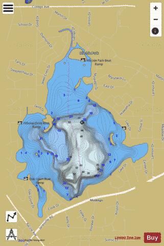

Little Muskego Lake Fishing Map Stats | |
| Title | Little Muskego Lake |
| Scale | 1:12000 |
| Counties | Waukesha |
| Nearby Cities | Muskego, New Berlin, Big Bend, Wind Lake, Hales Corners, Tichigan, Franklin, Vernon, Waukesha, Greenfield |
| Area * | 471.41 acres |
| Shoreline * | 7.60 miles |
| Min Longitude | -88.15 |
| Min Latitude | 42.90 |
| Max Longitude | -88.13 |
| Max Latitude | 42.93 |
| Edition Label 1 | |
| Edition Label 2 | |
| Edition Label 3 | |
| Id | US_AA_WI_little_muskego_lake_wi |
| Country | US |
| Projection | Mercator |
| * some Stats may include nearby/connecting waterbodies | |
|