Lake Ellen fishing map is available as part of iBoating : USA Marine & Fishing App(now supported on multiple platforms including Android, iPhone/iPad, MacBook, and Windows(tablet and phone)/PC based chartplotter.).
With our Lake Maps App, you get all the great marine chart app features like fishing spots, along with Lake Ellen depth map. The fishing maps app include HD lake depth contours, along with advanced features found in Fish Finder / Gps Chart Plotter systems, turning your device into a Depth Finder. The Lake Ellen Navigation App provides advanced features of a Marine Chartplotter including adjusting water level offset and custom depth shading. Fishing spots and depth contours layers are available in most Lake maps. Lake navigation features include advanced instrumentation to gather wind speed direction, water temperature, water depth, and accurate GPS with AIS receivers(using NMEA over TCP/UDP). Autopilot support can be enabled during ‘Goto WayPoint’ and ‘Route Assistance’.
Now i-Boating supports Fishing Points in Lake Ellen.
Have more questions about the Nautical Chart App? Ask us.
Fishing Info for Lake Ellen
Lake Ellen is a lake located near Cascade, Wisconsin, approximately 44 miles (71 km) northwest of Milwaukee, and is a 121-acre (0.49 km2) lake with a maximum depth of 42 feet (13 m). Used for recreational boating, fishing and swimming, it is surrounded by cabins and small cottages. The lake is also home to largemouth bass, northern pike and panfish, including bluegills, crappies, yellow perch, pumpkinseed sunfish, rock bass and white bass. The Department of Natural Resources stocks about 12,000 walleye fingerlings every other year.
More on Wikipedia...Popular fish species in this lake include Largemouth bass, Northern pike, Panfish, Pumpkinseed, Rock bass, Walleye, White bass and Yellow perch.
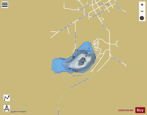
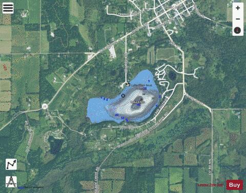
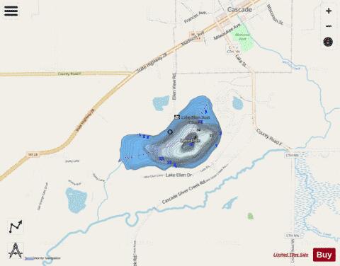
Lake Ellen Fishing Map Stats | |
| Title | Lake Ellen |
| Scale | 1:3000 |
| Counties | Sheboygan |
| Nearby Cities | Cascade, Batavia, Adell, Waldo, Hingham, Plymouth, Random Lake, Greenbush, Glenbeulah, Waubeka |
| Area * | 111.96 acres |
| Shoreline * | 1.89 miles |
| Min Longitude | -88.02 |
| Min Latitude | 43.64 |
| Max Longitude | -88.01 |
| Max Latitude | 43.65 |
| Edition Label 1 | |
| Edition Label 2 | |
| Edition Label 3 | |
| Id | US_AA_WI_lake_ellen__wi |
| Country | US |
| Projection | Mercator |
| * some Stats may include nearby/connecting waterbodies | |
|