Sylvan Lake fishing map is available as part of iBoating : USA Marine & Fishing App(now supported on multiple platforms including Android, iPhone/iPad, MacBook, and Windows(tablet and phone)/PC based chartplotter.).
With our Lake Maps App, you get all the great marine chart app features like fishing spots, along with Sylvan Lake depth map. The fishing maps app include HD lake depth contours, along with advanced features found in Fish Finder / Gps Chart Plotter systems, turning your device into a Depth Finder. The Sylvan Lake Navigation App provides advanced features of a Marine Chartplotter including adjusting water level offset and custom depth shading. Fishing spots and depth contours layers are available in most Lake maps. Lake navigation features include advanced instrumentation to gather wind speed direction, water temperature, water depth, and accurate GPS with AIS receivers(using NMEA over TCP/UDP). Autopilot support can be enabled during ‘Goto WayPoint’ and ‘Route Assistance’.
Now i-Boating supports Fishing Points in Sylvan Lake.
Have more questions about the Nautical Chart App? Ask us.
Fishing Info for Sylvan Lake
Sylvan Lake is located next to the community by that name in the Town of Beekman, New York, United States. It is the deepest and second-largest lake in Dutchess County. It is a popular local recreation spot. Many summer camps are located along it, as well as a large private campground. Many residents from Chelsea Cove also use the lake recreationally.
More on Wikipedia...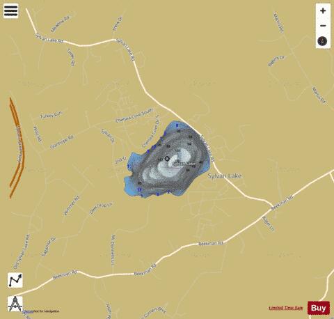
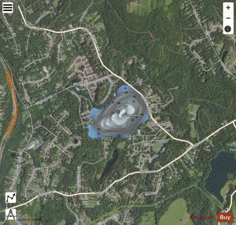
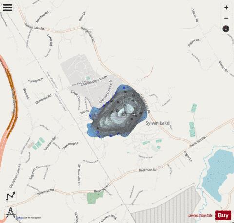
Sylvan Lake Fishing Map Stats | |
| Title | Sylvan Lake |
| Scale | 1:6000 |
| Counties | Dutchess |
| Nearby Cities | Beekman, Hopewell Junction, East Fishkill, Freedom Plains, Myers Corner, Brinckerhoff, Red Oaks Mill, Titusville, Pawling, Pleasant Valley |
| Area * | 119.36 acres |
| Shoreline * | 1.82 miles |
| Min Longitude | -73.75 |
| Min Latitude | 41.61 |
| Max Longitude | -73.74 |
| Max Latitude | 41.61 |
| Edition Label 1 | |
| Edition Label 2 | |
| Edition Label 3 | |
| Id | US_AA_NY_sylvan_lake_ny |
| Country | US |
| Projection | Mercator |
| * some Stats may include nearby/connecting waterbodies | |
|