Spitfire Lake fishing map is available as part of iBoating : USA Marine & Fishing App(now supported on multiple platforms including Android, iPhone/iPad, MacBook, and Windows(tablet and phone)/PC based chartplotter.).
With our Lake Maps App, you get all the great marine chart app features like fishing spots, along with Spitfire Lake depth map. The fishing maps app include HD lake depth contours, along with advanced features found in Fish Finder / Gps Chart Plotter systems, turning your device into a Depth Finder. The Spitfire Lake Navigation App provides advanced features of a Marine Chartplotter including adjusting water level offset and custom depth shading. Fishing spots and depth contours layers are available in most Lake maps. Lake navigation features include advanced instrumentation to gather wind speed direction, water temperature, water depth, and accurate GPS with AIS receivers(using NMEA over TCP/UDP). Autopilot support can be enabled during ‘Goto WayPoint’ and ‘Route Assistance’.
Now i-Boating supports Fishing Points in Spitfire Lake.
Have more questions about the Nautical Chart App? Ask us.
Fishing Info for Spitfire Lake
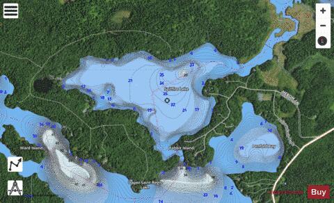
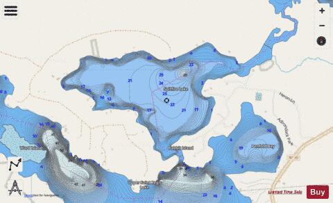
Spitfire Lake is a part of the St. Regis River in the Adirondacks in northern New York State and is 250-acre (1.0 km2) in area. Along with Upper and Lower St. Regis Lake, it became famous in the late 19th century as a summer playground of America's power elite, drawn to the area by its scenic beauty and by the rustic charms of Paul Smith's Hotel. It is the site of many grand old summer "cottages" and Great Camps; Frederick W. Vanderbilt, Anson Phelps Stokes and Whitelaw Reid were among the summer residents. "The camps of many of these families began as tent colonies, with separate units for sleeping, dining, games, and so on, and evolved into permanent structures built with understated taste." Spitfire is part of the original Seven Carries canoe route from Paul Smith's Hotel to Saranac Inn. * The Inlet, Spitfire Lake, 1903 * A "Camp" on Spitfire Lake * Boat house on Spitfire Lake
More on Wikipedia...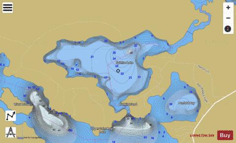
Spitfire Lake Fishing Map Stats | |
| Title | Spitfire Lake |
| Scale | 1:12000 |
| Counties | Franklin |
| Nearby Cities | Paul Smiths, Lake Clear, Harrietstown, Saranac Lake, Loon Lake, Tupper Lake, Santa Clara, Lake Placid, Piercefield, North Elba |
| Area * | 268.83 acres |
| Shoreline * | 4.17 miles |
| Min Longitude | -74.29 |
| Min Latitude | 44.41 |
| Max Longitude | -74.26 |
| Max Latitude | 44.42 |
| Edition Label 1 | |
| Edition Label 2 | |
| Edition Label 3 | |
| Id | US_AA_NY_spitfire_lake_ny |
| Country | US |
| Projection | Mercator |
| * some Stats may include nearby/connecting waterbodies | |
|