Bancroft Lake fishing map is available as part of iBoating : USA Marine & Fishing App(now supported on multiple platforms including Android, iPhone/iPad, MacBook, and Windows(tablet and phone)/PC based chartplotter.).
With our Lake Maps App, you get all the great marine chart app features like fishing spots, along with Bancroft Lake depth map. The fishing maps app include HD lake depth contours, along with advanced features found in Fish Finder / Gps Chart Plotter systems, turning your device into a Depth Finder. The Bancroft Lake Navigation App provides advanced features of a Marine Chartplotter including adjusting water level offset and custom depth shading. Fishing spots and depth contours layers are available in most Lake maps. Lake navigation features include advanced instrumentation to gather wind speed direction, water temperature, water depth, and accurate GPS with AIS receivers(using NMEA over TCP/UDP). Autopilot support can be enabled during ‘Goto WayPoint’ and ‘Route Assistance’.
Now i-Boating supports Fishing Points in Bancroft Lake.
Have more questions about the Nautical Chart App? Ask us.
Fishing Info for Bancroft Lake
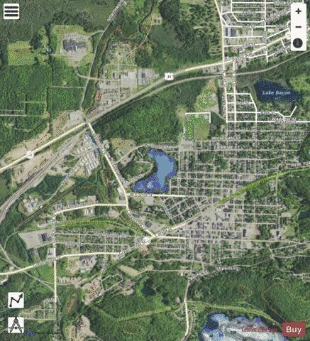
Lake Bancroft is a lake located in the city of Ishpeming in the U.S. state of Michigan. The lake has experienced progressive eutrophication resulting in hypoxia, disrupting its natural ecology. The Lake Bancroft Project, appointed by the Ishpeming City Council, aim to reverse the damage caused by eutrophication in a process using a food-grade polymer which binds itself to suspended material then brings it to the bottom of the lake.
More on Wikipedia...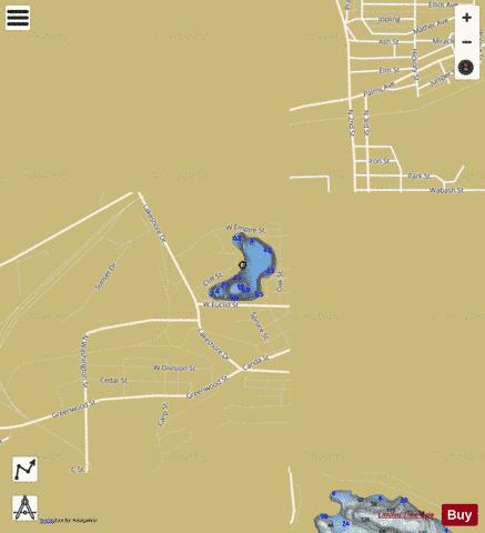
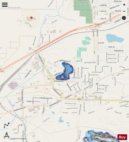
Bancroft Lake Fishing Map Stats | |
| Title | Bancroft Lake |
| Scale | 1:6000 |
| Includes Data from Fish Atlas | Yes |
| Counties | Marquette |
| Nearby Cities | Ishpeming, West Ishpeming, National Mine, Negaunee, Palmer, Trowbridge Park, Marquette, Princeton, Champion, Republic |
| Area * | 20.83 acres |
| Shoreline * | 0.90 miles |
| Min Longitude | -87.68 |
| Min Latitude | 46.49 |
| Max Longitude | -87.67 |
| Max Latitude | 46.50 |
| Edition Label 1 | |
| Edition Label 2 | |
| Edition Label 3 | |
| Id | US_AA_MI_bancroft_lake__mi |
| Country | US |
| Projection | Mercator |
| * some Stats may include nearby/connecting waterbodies | |
|