Jacobs Pond fishing map is available as part of iBoating : USA Marine & Fishing App(now supported on multiple platforms including Android, iPhone/iPad, MacBook, and Windows(tablet and phone)/PC based chartplotter.).
With our Lake Maps App, you get all the great marine chart app features like fishing spots, along with Jacobs Pond depth map. The fishing maps app include HD lake depth contours, along with advanced features found in Fish Finder / Gps Chart Plotter systems, turning your device into a Depth Finder. The Jacobs Pond Navigation App provides advanced features of a Marine Chartplotter including adjusting water level offset and custom depth shading. Fishing spots and depth contours layers are available in most Lake maps. Lake navigation features include advanced instrumentation to gather wind speed direction, water temperature, water depth, and accurate GPS with AIS receivers(using NMEA over TCP/UDP). Autopilot support can be enabled during ‘Goto WayPoint’ and ‘Route Assistance’.
Now i-Boating supports Fishing Points in Jacobs Pond.
Have more questions about the Nautical Chart App? Ask us.
Fishing Info for Jacobs Pond
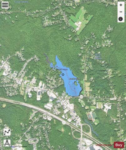
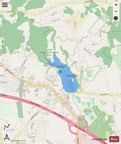
Jacobs Pond is a 59-acre (240,000 m2) pond in Norwell, Massachusetts. The pond is located alongside Assinippi, a village in neighboring Hanover. Route 123 runs along the southern shore of the pond. The pond is the headwaters of Third Herring Brook, a tributary of the North River which is the town line between Norwell and the eastern boundary of Hanover. The water quality is impaired due to non-native aquatic plants and non-native fish in the pond. The South Shore Natural Science Center is located near this pond. The infamous “Jacobs Monster” is also rumored to lurk beneath the depths of the water.
More on Wikipedia...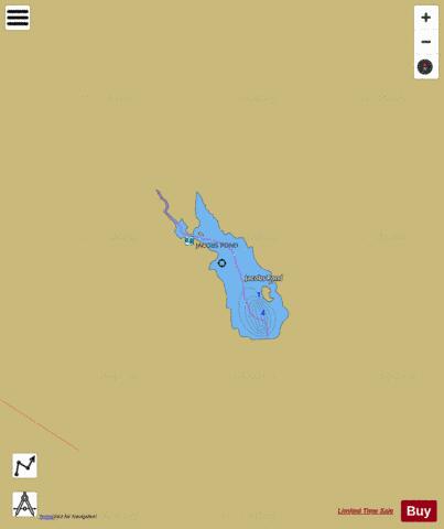
Jacobs Pond Fishing Map Stats | |
| Title | Jacobs Pond |
| Scale | 1:3000 |
| Counties | Plymouth |
| Nearby Cities | Assinippi, North Hanover, Accord, Liberty Plain, Hanover Center, Norwell, West Hanover, Beechwood, Hanover, Rockland |
| Area * | 60.79 acres |
| Shoreline * | 2.62 miles |
| Min Longitude | -70.86 |
| Min Latitude | 42.16 |
| Max Longitude | -70.85 |
| Max Latitude | 42.17 |
| Edition Label 1 | |
| Edition Label 2 | |
| Edition Label 3 | |
| Id | US_AA_MA_jacobs_pond_ma |
| Country | US |
| Projection | Mercator |
| * some Stats may include nearby/connecting waterbodies | |
|