Fearing Pond fishing map is available as part of iBoating : USA Marine & Fishing App(now supported on multiple platforms including Android, iPhone/iPad, MacBook, and Windows(tablet and phone)/PC based chartplotter.).
With our Lake Maps App, you get all the great marine chart app features like fishing spots, along with Fearing Pond depth map. The fishing maps app include HD lake depth contours, along with advanced features found in Fish Finder / Gps Chart Plotter systems, turning your device into a Depth Finder. The Fearing Pond Navigation App provides advanced features of a Marine Chartplotter including adjusting water level offset and custom depth shading. Fishing spots and depth contours layers are available in most Lake maps. Lake navigation features include advanced instrumentation to gather wind speed direction, water temperature, water depth, and accurate GPS with AIS receivers(using NMEA over TCP/UDP). Autopilot support can be enabled during ‘Goto WayPoint’ and ‘Route Assistance’.
Now i-Boating supports Fishing Points in Fearing Pond.
Have more questions about the Nautical Chart App? Ask us.
Fishing Info for Fearing Pond
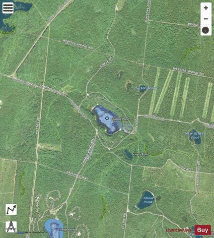
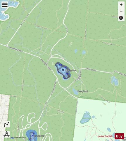
Fearing Pond, also erroneously named on some maps as Fearings Pond (pronounced to rhyme with bearing), is a 24-acre (97,000 m2) natural kettlehole pond in Plymouth, Massachusetts. The average depth is ten feet and the maximum depth is 20 feet (6.1 m). It is located in the southern section of Myles Standish State Forest, north of Charge Pond, northwest of Abner Pond, west of Fawn Pond, south of College Pond, southeast of East Head Reservoir, and east of the forest headquarters. However there is no direct access as the bridge over the Wankinco River connecting Cranberry Road in Carver and Fearing Pond Road in Plymouth was washed out several years ago. The bridge has not been rebuilt. Camp Cachalot and Camp Squanto are nearby. The pond is fed by groundwater. A public beach is located on the southeast side of the pond and on the northern side of the pond is where boating access is available. Summer cottages and campsites line the perimeter of the pond. The pond is usually stocked by MassWildlife
More on Wikipedia...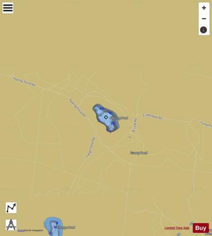
Fearing Pond Fishing Map Stats | |
| Title | Fearing Pond |
| Scale | 1:3000 |
| Counties | Plymouth |
| Nearby Cities | White Island Shores, The Pinehills, Wareham, Onset, Buzzards Bay, West Wareham, Carver, Bourne, Monument Beach, Plymouth |
| Area * | 22.51 acres |
| Shoreline * | 0.77 miles |
| Min Longitude | -70.67 |
| Min Latitude | 41.83 |
| Max Longitude | -70.66 |
| Max Latitude | 41.83 |
| Edition Label 1 | |
| Edition Label 2 | |
| Edition Label 3 | |
| Id | US_AA_MA_fearing_pond__ma |
| Country | US |
| Projection | Mercator |
| * some Stats may include nearby/connecting waterbodies | |
|