Emma Matilda Lake fishing map is available as part of iBoating : USA Marine & Fishing App(now supported on multiple platforms including Android, iPhone/iPad, MacBook, and Windows(tablet and phone)/PC based chartplotter.).
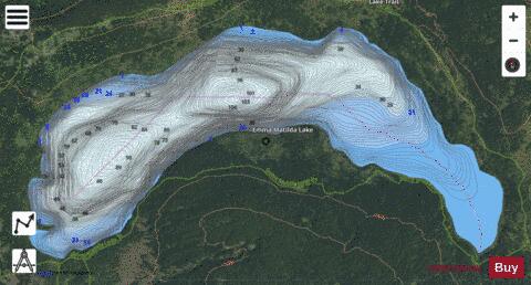
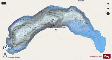
With our Lake Maps App, you get all the great marine chart app features like fishing spots, along with Emma Matilda Lake depth map. The fishing maps app include HD lake depth contours, along with advanced features found in Fish Finder / Gps Chart Plotter systems, turning your device into a Depth Finder. The Emma Matilda Lake Navigation App provides advanced features of a Marine Chartplotter including adjusting water level offset and custom depth shading. Fishing spots and depth contours layers are available in most Lake maps. Lake navigation features include advanced instrumentation to gather wind speed direction, water temperature, water depth, and accurate GPS with AIS receivers(using NMEA over TCP/UDP). Autopilot support can be enabled during ‘Goto WayPoint’ and ‘Route Assistance’.
Now i-Boating supports Fishing Points in Emma Matilda Lake.
Have more questions about the Nautical Chart App? Ask us.
Fishing Info for Emma Matilda Lake
Emma Matilda Lake is located in Grand Teton National Park, in the U. S. state of Wyoming. The lake is named after the wife of William O. Owen who was the first, along with three other climbers, to ascend to the summit of Grand Teton in 1898. The natural lake is 2.7 miles (4.3 km) long and can be reached by way of a 1-mile (1.6 km) hike from a parking area at Two Ocean Lake or via a slightly longer hike from Jackson Lake Lodge. The 10.7-mile (17.2 km) Emma Matilda Lake Trail circles the lake and offers distant views of the Teton Range.
More on Wikipedia...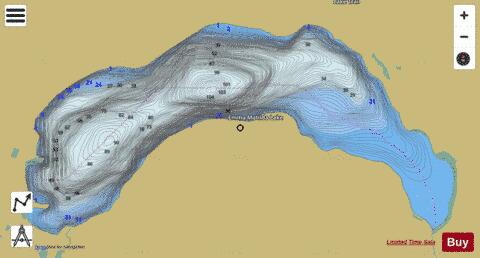
Emma Matilda Lake Fishing Map Stats | |
| Title | Emma Matilda Lake |
| Scale | 1:6000 |
| Counties | Teton |
| Nearby Cities | Moran, Grovont, Kelly, Moose, Teton Village, Jackson, Wilson, Alta, West Thumb, Driggs |
| Area * | 890.99 acres |
| Shoreline * | 7.41 miles |
| Min Longitude | -110.56 |
| Min Latitude | 43.88 |
| Max Longitude | -110.51 |
| Max Latitude | 43.89 |
| Edition Label 1 | |
| Edition Label 2 | |
| Edition Label 3 | |
| Id | US_WY_01599615 |
| Country | US |
| Projection | Mercator |
| * some Stats may include nearby/connecting waterbodies | |
|