How to Find Fish Faster Using Depth Range Highlighting
What Is Fishing Depth Range Highlighting?
Why Does Water Depth Matter for Fishing?
Why Highlighting a Depth Range Changes How You Fish
How to Enable Highlight Fishing Depth Range in i-Boating
Pro Tips: Combining Depth Range Highlighting with Other i-Boating Features
Highlight Depth Range In Action
Does Highlight Fishing Depth Range work offline?
What happens if the reservoir water level drops by 5 feet?
Does depth highlighting work with high-resolution bathymetry?
Does highlighting a depth range guarantee that fish will be present?
How Accurate Is Fishing Depth Range Highlighting?
Does Depth Offset affect automatic routing?
What Is Fishing Depth Range Highlighting?
Fishing depth range highlighting is a feature in digital nautical chart apps that helps anglers quickly identify areas of a lake, river, or coastal waterway within a specific depth range.
Instead of manually following depth contour lines across a nautical chart, anglers can select a target depth range and visually distinguish areas that fall within that range.
For example, an angler targeting fish in 15–25 feet of water can use depth highlighting to locate areas within that interval. This makes it easier to identify potentially productive fishing locations, including underwater points, ledges, humps, and drop-offs.
Why Does Water Depth Matter for Fishing?
Water depth is one of several important factors influencing where fish are found.
Fish often move between different depths in response to seasonal changes, water temperature, dissolved oxygen, sunlight, food availability, and underwater structure.
For example:
- Spring: Some fish species move into shallower water for spawning.
- Summer: Fish may seek deeper, cooler water or remain near underwater structure.
- Fall: Fish often follow baitfish as they move between shallow and deeper areas.
- Winter: Some species concentrate in deeper or more stable water.
These patterns vary by species and waterbody. Depth highlighting helps anglers locate their target depth zones more efficiently, but it does not guarantee fish will be present.
Why Highlighting a Depth Range Changes How You Fish
- Replicate Patterns Across the Entire Lake: Suppose you catch two walleye or bass along a 12-to-15-foot weed edge on the north end of a lake. Instead of manually tracing contour lines around miles of shoreline to find similar structure, highlighting 12 ft – 15 ft immediately illuminates every single breakline, sunken island, and saddle in that exact depth range across the whole waterbody.
- Hold Precise Trolling & Drift Lines: When trolling crankbaits, planer boards, or downriggers, staying in a narrow depth corridor is critical. A highlighted depth band acts as a visual highway on your chartplotter, allowing you to steer along contour edges without constantly squinting at tiny depth sounding numbers.
- Identify Seasonal and Thermocline Zones: Fish often move between different depths as water temperatures change throughout the year. By combining i-Boating's Lake Temperature Maps with depth range highlighting, anglers can identify areas where favorable temperature conditions intersect their target bottom-depth range. For example, if fish are holding near a thermocline at 20–25 feet, highlighting that depth range can help locate underwater points, ledges, and humps that extend into the same depth zone
How to Enable Highlight Fishing Depth Range in i-Boating
You can configure your custom fishing depth range in seconds on iOS, Android, macOS, and Windows:
- Open your i-Boating chart and tap the Menu / Overflow button (bottom-right on iOS, top-right on Android).
- Select Settings.
- Scroll to the Highlight Fishing Depth Range (or Highlight Depth Range) section.
- Toggle the feature On and enter your Minimum Depth and Maximum Depth (for example, 10 ft to 15 ft, or the equivalent in meters/fathoms depending on your unit settings).
- Return to the map view—your selected depth band will now be visually shaded across the chart so you can spot matching structure immediately.
(Tip: Double-check that your depth units in Settings—Feet, Meters, or Fathoms—match the values you enter, and use i-Boating's Depth Offset setting if your lake or reservoir is currently above or below normal pool elevation.)
Pro Tips: Combining Depth Range Highlighting with Other i-Boating Features
Highlighting a depth band becomes even more powerful when layered with i-Boating’s other fishing tools:
- Pair with Relief Shading: Turn on Relief Shading alongside your highlighted depth range to see the true 3D shape of the underwater terrain—revealing subtle inside turns, rock piles, and hard-bottom transitions right inside your target depth zone.
- Cross-Reference with Lake Temperature Maps: Use i-Boating's Lake Temperature Maps alongside depth range highlighting to correlate water temperature patterns with underwater structure. This can help anglers narrow their search to locations where suitable temperatures, bottom depths, and structural features coincide
- Validate Spots with Fishing AI: Run Fishing Hot Spots AI and look for high-probability structural features (like point bars, humps, and channel bends) that fall directly inside your shaded depth corridor.
- Separate Fishing Zones from Navigation Hazards: Keep Custom Depth Shading configured for your boat’s shallow-water safety draft (e.g., 0–3 ft) so you maintain clear situational awareness of shoals and sandbars while focusing on deeper fishing contours.
- Hi-Resolution Bathymetry: Where available, detailed bathymetric contours help anglers identify smaller underwater features within their target depth range.
- Waypoints: Mark promising locations identified through depth highlighting so you can revisit them later.
- GPS Tracks: Record your fishing or trolling route to help reproduce successful fishing patterns.
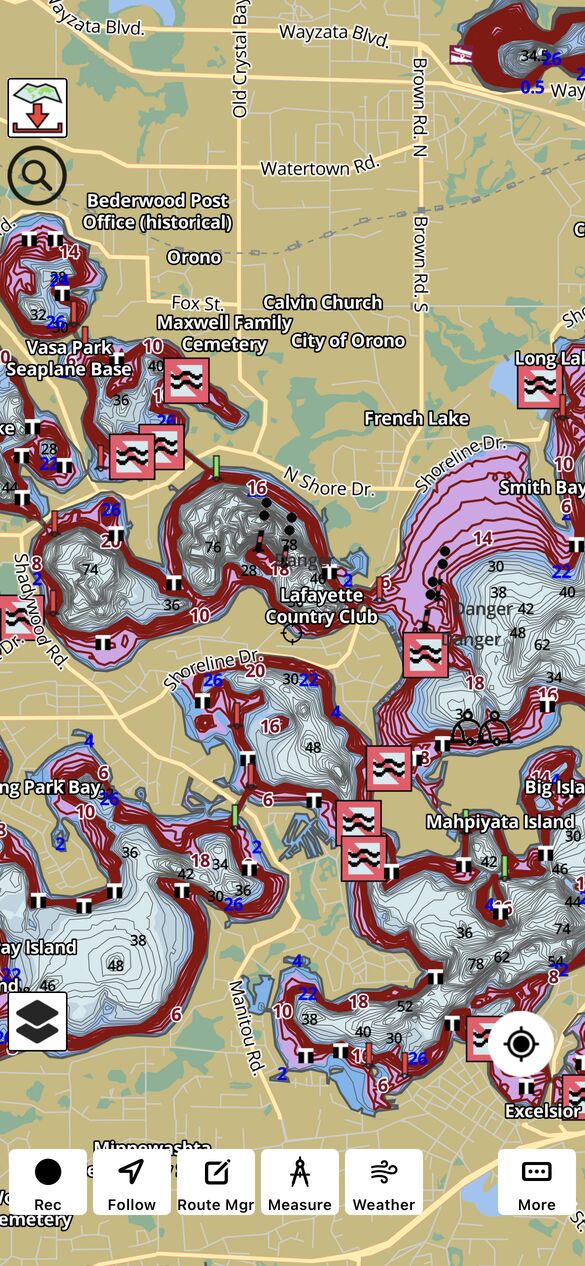
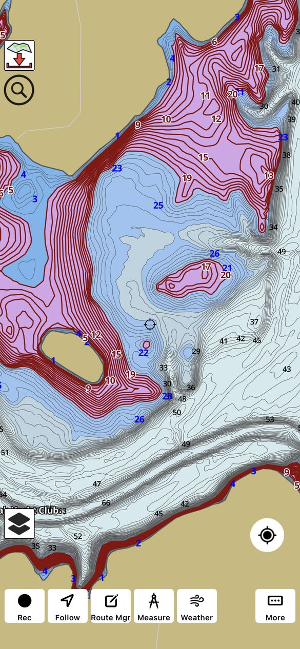
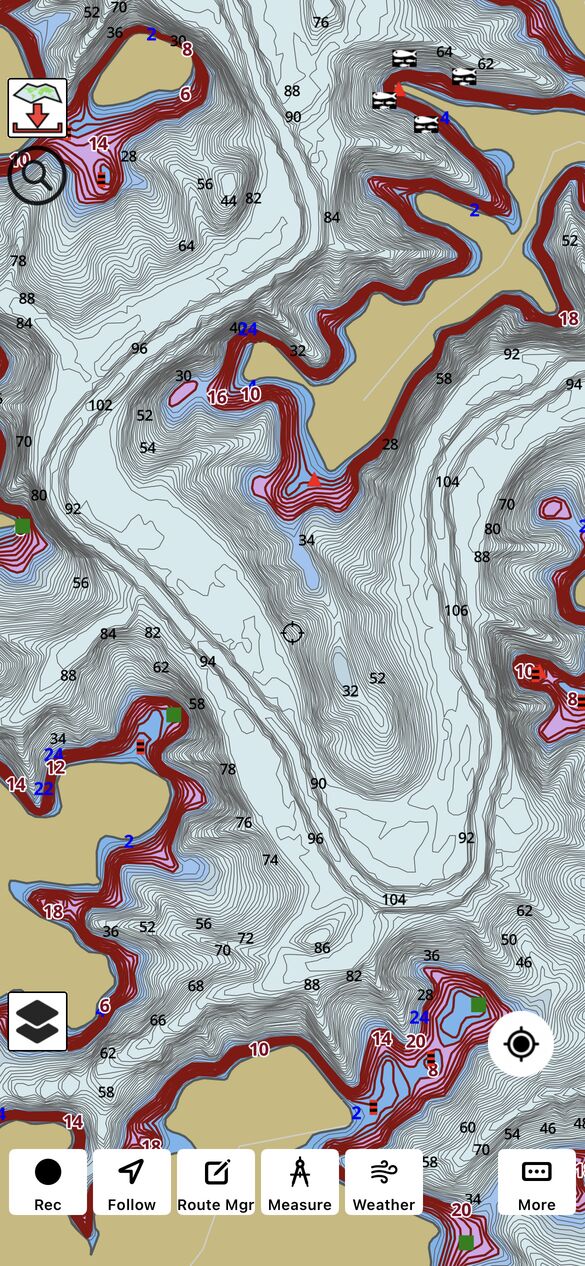
Highlight Depth Range In Action
Included below are a few screenshots showing highlight depth range in action.
Frequently Asked Questions
Does Highlight Fishing Depth Range work offline?
Yes. Once your lake maps or coastal ENC charts are downloaded to your device, depth range highlighting renders locally on-device with no cellular or internet connection required.
What happens if the reservoir water level drops by 5 feet?
i-Boating supports a Depth Offset setting that allows anglers to account for changes in lake or reservoir water levels.
For example, if a reservoir is 5 feet below its charted reference level, you can apply a depth offset of -5 feet. i-Boating adjusts the charted depths accordingly.
Depth range highlighting uses these adjusted depths, so highlighting 10–15 feet identifies areas whose calculated depths fall within that range after applying the offset.
The depth offset is also taken into account by other i-Boating algorithms, including automatic routing.
This is particularly useful when fishing reservoirs where water levels fluctuate significantly throughout the year.
Does depth highlighting work with high-resolution bathymetry?
Yes. Where high-resolution bathymetry (such as 1-foot or 3-foot contours) is available, depth range highlighting uses that detailed data—helping you pinpoint subtle underwater features, small humps, and tighter depth transitions.
Does highlighting a depth range guarantee that fish will be present?
No. Depth highlighting identifies areas matching your selected depth range. Fish location also depends on water temperature, oxygen, vegetation, food availability, season, and other environmental conditions.
How Accurate Is Fishing Depth Range Highlighting?
Depth highlighting is based on the bathymetric information available for a particular waterbody. The accuracy and detail of highlighted areas depend on the quality and resolution of the underlying chart data.
Actual water depths may differ from charted depths due to changing reservoir levels, sedimentation, erosion, and other factors.
Anglers should use depth highlighting as a planning and fishing aid rather than a substitute for real-time depth measurements from a sonar or fish finder.
Does Depth Offset affect automatic routing?
Yes. i-Boating's automatic routing algorithm takes the applied depth offset into account when calculating routes. This helps ensure that route calculations reflect the adjusted chart depths rather than the original charted depths.
Actual water depths can still differ from calculated depths, so boaters should verify conditions and use appropriate navigation precautions.