Lake Wappapello fishing map is available as part of iBoating : USA Marine & Fishing App(now supported on multiple platforms including Android, iPhone/iPad, MacBook, and Windows(tablet and phone)/PC based chartplotter.).
With our Lake Maps App, you get all the great marine chart app features like fishing spots, along with Lake Wappapello depth map. The fishing maps app include HD lake depth contours, along with advanced features found in Fish Finder / Gps Chart Plotter systems, turning your device into a Depth Finder. The Lake Wappapello Navigation App provides advanced features of a Marine Chartplotter including adjusting water level offset and custom depth shading. Fishing spots and depth contours layers are available in most Lake maps. Lake navigation features include advanced instrumentation to gather wind speed direction, water temperature, water depth, and accurate GPS with AIS receivers(using NMEA over TCP/UDP). Autopilot support can be enabled during ‘Goto WayPoint’ and ‘Route Assistance’.
Now i-Boating supports Fishing Points in Lake Wappapello.
Have more questions about the Nautical Chart App? Ask us.
Fishing Info for Lake Wappapello
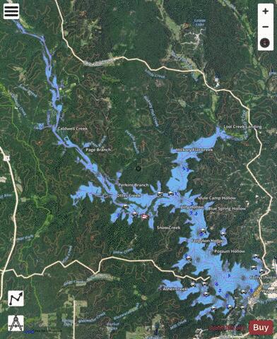
Lake Wappapello is a reservoir on the St. Francis River, formed by Wappapello Dam (36°55′55″N 90°16′45″W / 36.93194°N 90.27917°W). Created in 1941, this 8,400-acre (34 km2) lake is located 120 miles (190 km) south of St. Louis, Missouri. The reservoir lies mostly in Wayne County, but its southernmost reaches (near the dam) extend into northern Butler County, both in Missouri. Both the dam and reservoir are owned and operated for the public by the United States Army Corps of Engineers. Its primary purpose is flood control, although it has been developed as a recreational area with ample opportunities to boat, fish, swim or camp. The fish population of the lake include white bass, largemouth bass, crappie, and bluegill. Lake Wappapello State Park is composed of territory on the southwestern side of the lake.
More on Wikipedia...Popular fish species in this lake include Crappie, Largemouth bass and White bass.
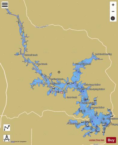
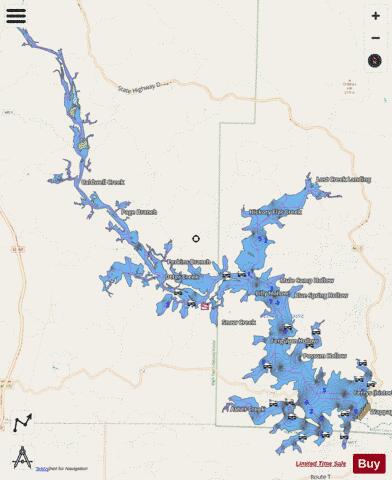
Lake Wappapello Fishing Map Stats | |
| Title | Lake Wappapello |
| Scale | 1:12000 |
| Counties | Butler, Wayne |
| Nearby Cities | Greenville, Rombauer, Silva, McGee, Puxico, Williamsville, Patterson, Fisk, Poplar Bluff, Lodi |
| Area * | 7675.89 acres |
| Shoreline * | 180.49 miles |
| Min Longitude | -90.45 |
| Min Latitude | 36.91 |
| Max Longitude | -90.27 |
| Max Latitude | 37.08 |
| Edition Label 1 | |
| Edition Label 2 | |
| Edition Label 3 | |
| Id | US_UB_MO_00728338 |
| Country | US |
| Projection | Mercator |
| * some Stats may include nearby/connecting waterbodies | |
|