Lavon fishing map is available as part of iBoating : USA Marine & Fishing App(now supported on multiple platforms including Android, iPhone/iPad, MacBook, and Windows(tablet and phone)/PC based chartplotter.).
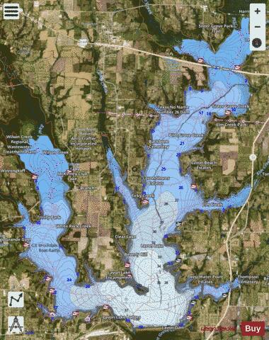
With our Lake Maps App, you get all the great marine chart app features like fishing spots, along with Lavon lake depth map. The fishing maps app include HD lake depth contours, along with advanced features found in Fish Finder / Gps Chart Plotter systems, turning your device into a Depth Finder. The Lavon Navigation App provides advanced features of a Marine Chartplotter including adjusting water level offset and custom depth shading. Fishing spots and depth contours layers are available in most Lake maps. Lake navigation features include advanced instrumentation to gather wind speed direction, water temperature, water depth, and accurate GPS with AIS receivers(using NMEA over TCP/UDP). Autopilot support can be enabled during ‘Goto WayPoint’ and ‘Route Assistance’.
Now i-Boating supports Fishing Points in Lavon.
Have more questions about the Nautical Chart App? Ask us.
Fishing Info for Lavon
Lavon Lake is a freshwater reservoir located in southeast Collin County, Texas, on the East Fork of the Trinity River near Wylie, off State Highway 78. It is commonly called Lake Lavon for commercial and recreational purposes, but Lavon Lake is its official name according to the U.S. Army Corps of Engineers. It was originally called Lavon Reservoir.
More on Wikipedia...Popular fish species in this lake include Crappie, Largemouth bass and White bass.
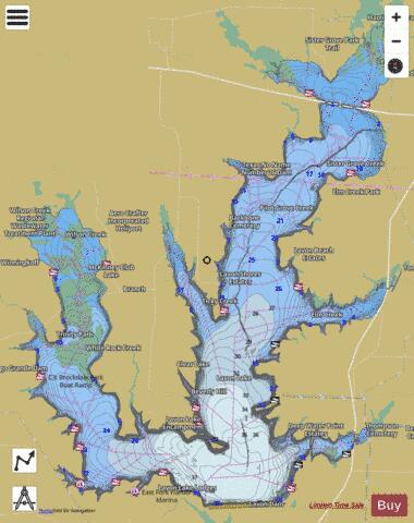
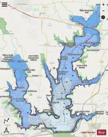
Lavon Fishing Map Stats | |
| Title | Lavon |
| Sailing Clubs in this Chart region | |
| Lavon Yacht Club | |
| Scale | 1:24000 |
| Counties | Collin |
| Nearby Cities | Saint Paul, Copeville, Lavon, Lucas, Wylie, Lowry Crossing, Princeton, Nevada, Farmersville, Parker |
| Area * | 19853.56 acres |
| Shoreline * | 115.23 miles |
| Min Longitude | -96.56 |
| Min Latitude | 33.03 |
| Max Longitude | -96.41 |
| Max Latitude | 33.19 |
| Edition Label 1 | |
| Edition Label 2 | |
| Edition Label 3 | |
| Id | US_TX_lavon |
| Country | US |
| Projection | Mercator |
| * some Stats may include nearby/connecting waterbodies | |
|