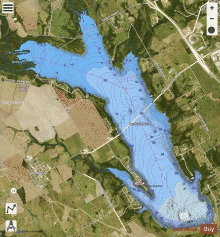
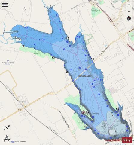
Bardwell fishing map is available as part of iBoating : USA Marine & Fishing App(now supported on multiple platforms including Android, iPhone/iPad, MacBook, and Windows(tablet and phone)/PC based chartplotter.).
With our Lake Maps App, you get all the great marine chart app features like fishing spots, along with Bardwell lake depth map. The fishing maps app include HD lake depth contours, along with advanced features found in Fish Finder / Gps Chart Plotter systems, turning your device into a Depth Finder. The Bardwell Navigation App provides advanced features of a Marine Chartplotter including adjusting water level offset and custom depth shading. Fishing spots and depth contours layers are available in most Lake maps. Lake navigation features include advanced instrumentation to gather wind speed direction, water temperature, water depth, and accurate GPS with AIS receivers(using NMEA over TCP/UDP). Autopilot support can be enabled during ‘Goto WayPoint’ and ‘Route Assistance’.
Now i-Boating supports Fishing Points in Bardwell.
Have more questions about the Nautical Chart App? Ask us.
Fishing Info for Bardwell
Lake Bardwell is a lake in Ellis County, Texas. The lake was constructed by the United States Army Corps of Engineers in 1965. Lake Bardwell is not used for military operations, and is accessible to the public for recreational purposes; it has seven facilities, but the state public ramp is closed.
More on Wikipedia...Popular fish species in this lake include Crappie, Largemouth bass and White bass.
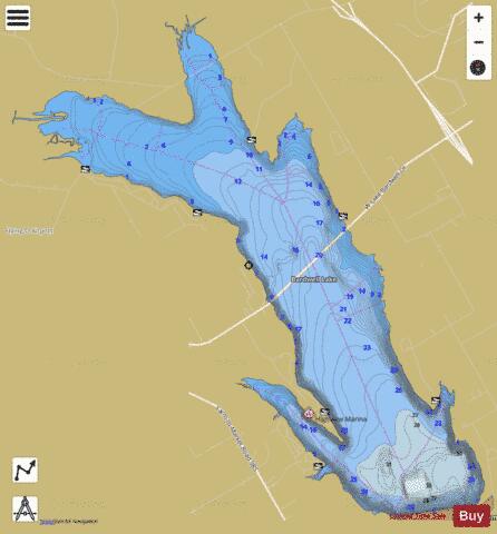
Bardwell Fishing Map Stats | |
| Title | Bardwell |
| Scale | 1:24000 |
| Counties | Ellis |
| Nearby Cities | Bardwell, Ennis, Garrett, Alma, Emhouse, Palmer, Rice, Barry, Waxahachie, Forreston |
| Area * | 3259.90 acres |
| Shoreline * | 27.02 miles |
| Min Longitude | -96.71 |
| Min Latitude | 32.25 |
| Max Longitude | -96.63 |
| Max Latitude | 32.32 |
| Edition Label 1 | |
| Edition Label 2 | |
| Edition Label 3 | |
| Id | US_TX_bardwell |
| Country | US |
| Projection | Mercator |
| * some Stats may include nearby/connecting waterbodies | |
|