Aquilla fishing map is available as part of iBoating : USA Marine & Fishing App(now supported on multiple platforms including Android, iPhone/iPad, MacBook, and Windows(tablet and phone)/PC based chartplotter.).
With our Lake Maps App, you get all the great marine chart app features like fishing spots, along with Aquilla lake depth map. The fishing maps app include HD lake depth contours, along with advanced features found in Fish Finder / Gps Chart Plotter systems, turning your device into a Depth Finder. The Aquilla Navigation App provides advanced features of a Marine Chartplotter including adjusting water level offset and custom depth shading. Fishing spots and depth contours layers are available in most Lake maps. Lake navigation features include advanced instrumentation to gather wind speed direction, water temperature, water depth, and accurate GPS with AIS receivers(using NMEA over TCP/UDP). Autopilot support can be enabled during ‘Goto WayPoint’ and ‘Route Assistance’.
Now i-Boating supports Fishing Points in Aquilla.
Have more questions about the Nautical Chart App? Ask us.
Fishing Info for Aquilla
Aquilla Lake is an artificial lake (reservoir) in Hill County, Texas, USA. The dam was constructed by the U.S. Army Corps of Engineers. The dam is part of the overall flood control project in the Brazos River basin. The lake is located approximately 23 miles (37 km) north of Waco, Texas, and directly north of the town of Aquilla. The dam was built and is owned by the U.S. Army Corps of Engineers. The lake is formed by an earthfill dam with a crest length of 11,890 feet (3,624 m) and a top width of 38 feet (11.6 m). A reinforced concrete inlet structure near the center of dam houses the flood-control gates and operating equipment. Closure of the dam began March 20, 1982, and the dam was completed in January 1983. Deliberate impoundment began April 29, 1983. The lake was built for water supply, flood control, and recreation purposes. Figures given herein represent total contents. Data regarding the dam and lake are given in the following table (USGS data): Recreational activities on the lake include boating, fishing, hunting, and wildlife viewing.
More on Wikipedia...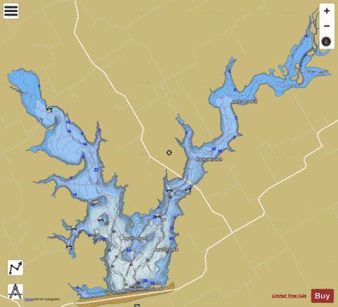
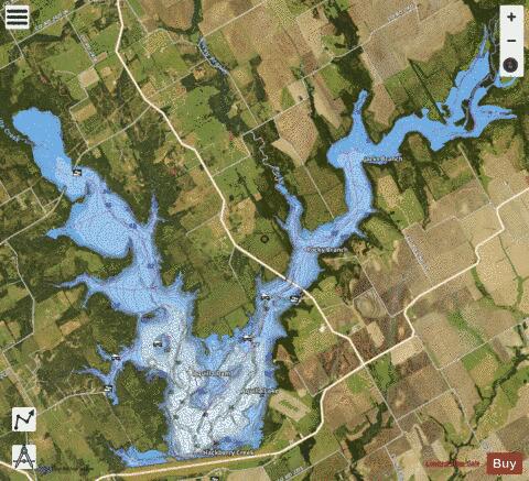
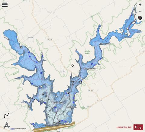
Aquilla Fishing Map Stats | |
| Title | Aquilla |
| Scale | 1:24000 |
| Counties | Hill |
| Nearby Cities | Hillsboro, Aquilla, Whitney, Abbott, Bynum, West, Carl's Corner, Laguna Park, Itasca, Gholson |
| Area * | 3649.61 acres |
| Shoreline * | 57.41 miles |
| Min Longitude | -97.24 |
| Min Latitude | 31.90 |
| Max Longitude | -97.14 |
| Max Latitude | 31.97 |
| Edition Label 1 | |
| Edition Label 2 | |
| Edition Label 3 | |
| Id | US_TX_aquilla |
| Country | US |
| Projection | Mercator |
| * some Stats may include nearby/connecting waterbodies | |
|