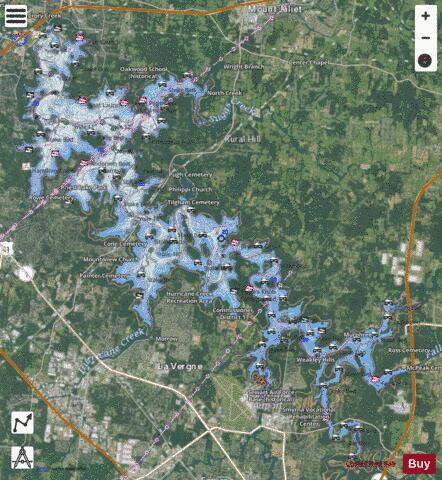
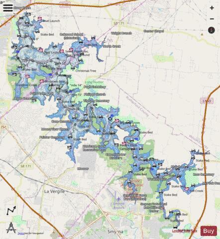
Percy Priest fishing map is available as part of iBoating : USA Marine & Fishing App(now supported on multiple platforms including Android, iPhone/iPad, MacBook, and Windows(tablet and phone)/PC based chartplotter.).
With our Lake Maps App, you get all the great marine chart app features like fishing spots, along with Percy Priest lake depth map. The fishing maps app include HD lake depth contours, along with advanced features found in Fish Finder / Gps Chart Plotter systems, turning your device into a Depth Finder. The Percy Priest Navigation App provides advanced features of a Marine Chartplotter including adjusting water level offset and custom depth shading. Fishing spots and depth contours layers are available in most Lake maps. Lake navigation features include advanced instrumentation to gather wind speed direction, water temperature, water depth, and accurate GPS with AIS receivers(using NMEA over TCP/UDP). Autopilot support can be enabled during ‘Goto WayPoint’ and ‘Route Assistance’.
Now i-Boating supports Fishing Points in Percy Priest.
Have more questions about the Nautical Chart App? Ask us.
Fishing Info for Percy Priest
J. Percy Priest Lake is a reservoir in north central part of Tennessee. It is formed by J. Percy Priest Dam, located between miles six and seven of the Stones River. The dam (easily visible from Interstate 40) is located about 10 miles (16 km) east of downtown Nashville and impounds a lake 42 mi (68 km) long. The lake and dam are named for Congressman Percy Priest. The lake covers portions of Davidson, Rutherford and Wilson counties and consists of 14,200 acres (5,700 ha) of water at summer pool elevation 490 feet (150 m) above mean sea level. The water is surrounded by 18,854 acres (7,630 ha) of public lands; 10,000 acres (4,000 ha) are devoted to wildlife management. The site of the former town of Old Jefferson was inundated by the reservoir; the community was demolished in the early 1960s for the building of the dam. The Percy Priest dam project was first authorized by the U.S. Congress in 1946 under the name "Stewarts Ferry Reservoir." An act of Congress approved July 2, 1958, changed the name to honor Congressman Priest. The U.S. Army Corps of Engineers project was completed in 1967. The dam, powerhouse, lake and public lands are operated and supervised by the Corps of Engineers' Nashville District personnel. The Natural Resource Management Office maintains three campgrounds (Anderson Road, Seven Points and Poole Knobs), eleven day-use/picnic areas (Anderson Road, Cook, Damsite, East Fork, Fate Sanders, Jefferson Springs, Nice's Mill, Overlook, Seven Points, Smith Springs and Tailwater) and twelve boat launching ramps (Anderson Road, Cook, East Fork, Fall Creek, Fate Sanders, Hurricane Creek, Jefferson Springs, Lamar Hill, Mona, Nice's Mill, Poole Knobs, Seven Points, Smith Springs, Stewart's Creek and Viverett Creek). Marinas at the lake include Nashville Shores, Elm Hill, Four Corners, Fate Sanders, Hamilton Creek and Percy Priest. The lake is also home to a number of recreational organizations such as the Tennessee Boat Club, Percy Priest Yacht Club, Vanderbilt Sailing Club, the Vanderbilt Rowing Club and the Nashville Rowing Club. The lake is mentioned in the song "Cover Me Up" by musician Jason Isbell, and later in a cover sung by Morgan Wallen. On May 29, 2021, a Cessna Citation I/SP private jet crashed into the lake, killing all seven on board, including actor Joe Lara and Christian author and dietician Gwen Shamblin Lara.
More on Wikipedia...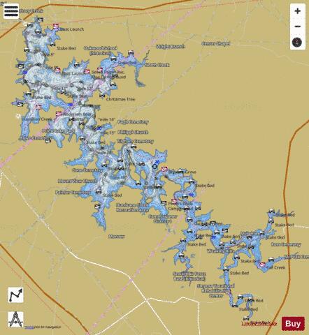
Percy Priest Fishing Map Stats | |
| Title | Percy Priest |
| Scale | 1:12000 |
| Counties | Davidson, Rutherford, Wilson |
| Nearby Cities | Smyrna, La Vergne, Rural Hill, Belinda City, Mount Juliet, Gladeville, Green Hill, Lakewood (historical), Walterhill, Nolensville |
| Area * | 14034.70 acres |
| Shoreline * | 164.53 miles |
| Min Longitude | -86.63 |
| Min Latitude | 35.99 |
| Max Longitude | -86.42 |
| Max Latitude | 36.16 |
| Edition Label 1 | |
| Edition Label 2 | |
| Edition Label 3 | |
| Id | US_TN_01313401 |
| Country | US |
| Projection | Mercator |
| * some Stats may include nearby/connecting waterbodies | |
|