Clarke, Aldred, Conowingo fishing map is available as part of iBoating : USA Marine & Fishing App(now supported on multiple platforms including Android, iPhone/iPad, MacBook, and Windows(tablet and phone)/PC based chartplotter.).
With our Lake Maps App, you get all the great marine chart app features like fishing spots, along with Clarke, Aldred, Conowingo lake depth map. The fishing maps app include HD lake depth contours, along with advanced features found in Fish Finder / Gps Chart Plotter systems, turning your device into a Depth Finder. The Clarke, Aldred, Conowingo Navigation App provides advanced features of a Marine Chartplotter including adjusting water level offset and custom depth shading. Fishing spots and depth contours layers are available in most Lake maps. Lake navigation features include advanced instrumentation to gather wind speed direction, water temperature, water depth, and accurate GPS with AIS receivers(using NMEA over TCP/UDP). Autopilot support can be enabled during ‘Goto WayPoint’ and ‘Route Assistance’.
Now i-Boating supports Fishing Points in Clarke, Aldred, Conowingo.
Have more questions about the Nautical Chart App? Ask us.
Fishing Info for Clarke, Aldred, Conowingo
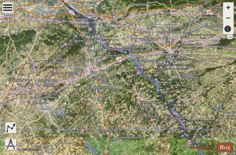
Lake Clarke in Pennsylvania is a man-made lake along the Susquehanna River formed by the Safe Harbor Dam, a public works project of the 1930s Great Depression and one of the electrification projects of the New Deal. It is approximately 12 miles (19 km) long centered within the Conejohela Valley approximately 6 miles (9.7 km) downstream of historic Wright's Ferry (1630−1901). Safe Harbor Water Power Corporation provides picnic areas, boat ramps, playgrounds and other public recreation facilities at several locations on both sides of the lake. Lake Clarke is home to Long Level Marina, Safe Harbor's boat-access areas, Susquehanna Yacht Club, Lake Clarke Rescue Inc., and two private marinas that are located on the York County side of the lake. The United States Coast Guard Auxiliary has several flotillas of Division 19 (5th Northern Region) that patrol the area of Lake Clarke and is based out of Station Long Level located on the York side of the lake.
More on Wikipedia...Popular fish species in this lake include Muskellunge/Walleye/Northern Pike and Smallmouth Bass.
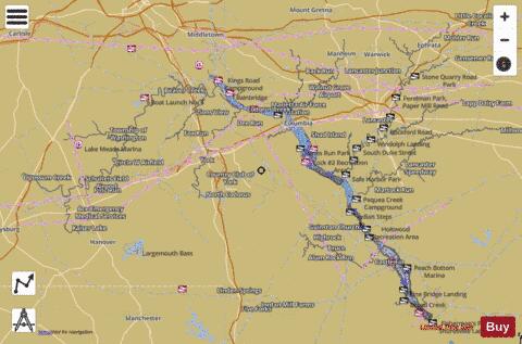
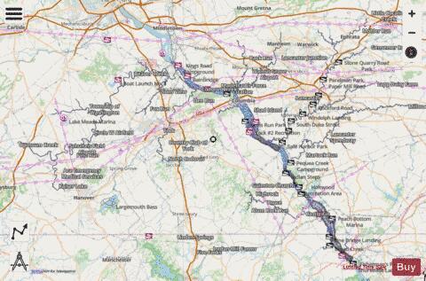
Clarke, Aldred, Conowingo Fishing Map Stats | |
| Title | Clarke, Aldred, Conowingo |
| Sailing Clubs in this Chart region | |
| Susquehanna Yacht Club | |
| Scale | 1:12000 |
| Counties | Cecil, Harford, Adams, Lancaster, York |
| Nearby Cities | Paradise, Marietta, Wrightsville, Brownstown, Washington Boro, Ephrata, Bainbridge, York Haven, East Berlin, Holtwood |
| Area * | 26465.37 acres |
| Shoreline * | 873.76 miles |
| Min Longitude | -77.19 |
| Min Latitude | 39.66 |
| Max Longitude | -76.00 |
| Max Latitude | 40.22 |
| Edition Label 1 | |
| Edition Label 2 | |
| Edition Label 3 | |
| Id | US_PA_clarke_aldred_conowingo |
| Country | US |
| Projection | Mercator |
| * some Stats may include nearby/connecting waterbodies | |
|