Elk Lake fishing map is available as part of iBoating : USA Marine & Fishing App(now supported on multiple platforms including Android, iPhone/iPad, MacBook, and Windows(tablet and phone)/PC based chartplotter.).
With our Lake Maps App, you get all the great marine chart app features like fishing spots, along with Elk Lake depth map. The fishing maps app include HD lake depth contours, along with advanced features found in Fish Finder / Gps Chart Plotter systems, turning your device into a Depth Finder. The Elk Lake Navigation App provides advanced features of a Marine Chartplotter including adjusting water level offset and custom depth shading. Fishing spots and depth contours layers are available in most Lake maps. Lake navigation features include advanced instrumentation to gather wind speed direction, water temperature, water depth, and accurate GPS with AIS receivers(using NMEA over TCP/UDP). Autopilot support can be enabled during ‘Goto WayPoint’ and ‘Route Assistance’.
Now i-Boating supports Fishing Points in Elk Lake.
Have more questions about the Nautical Chart App? Ask us.
Fishing Info for Elk Lake
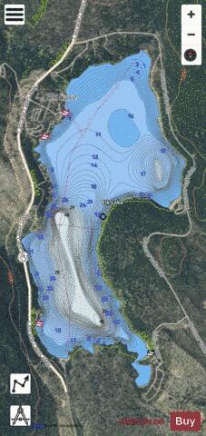
Elk Lake is a natural body of water in the central Cascade Range in the U.S. state of Oregon. Nearly 4,900 feet (1,500 m) above sea level, the lake is part of a volcanic landscape about 25 miles (40 km) west-southwest of Bend along the Cascade Lakes Scenic Byway. Elk Lake is about 6 miles (10 km) west of Mount Bachelor in Deschutes National Forest. Nearby lakes include Hosmer, Sparks, Blow, Doris, Devils, Lava, and Little Lava. Heavily used for recreation, the lake is among the most popular of the Cascade Lakes. Its name stems from the large number of elk that formerly frequented the area in summer. During winter, Elk Lake freezes, and access roads are usually closed by snow until late May.
More on Wikipedia...Popular fish species in this lake include Brook trout.
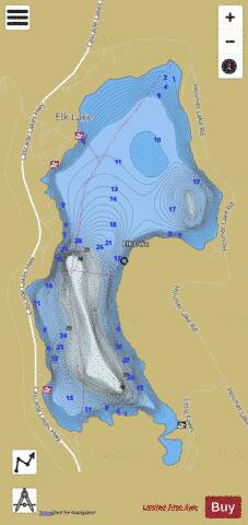
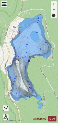
Elk Lake Fishing Map Stats | |
| Title | Elk Lake |
| Scale | 1:6000 |
| Counties | Deschutes |
| Nearby Cities | Sisters, McKenzie Bridge, La Pine, Crescent Lake, Bend, Tumalo, Gilchrist, Camp Sherman, Crescent, McCredie Springs |
| Area * | 386.91 acres |
| Shoreline * | 5.09 miles |
| Min Longitude | -121.81 |
| Min Latitude | 43.96 |
| Max Longitude | -121.79 |
| Max Latitude | 43.98 |
| Edition Label 1 | |
| Edition Label 2 | |
| Edition Label 3 | |
| Id | US_OR_ordfw_m_elk_lake_nf4625 |
| Country | US |
| Projection | Mercator |
| * some Stats may include nearby/connecting waterbodies | |
|