Lookout Point Lake fishing map is available as part of iBoating : USA Marine & Fishing App(now supported on multiple platforms including Android, iPhone/iPad, MacBook, and Windows(tablet and phone)/PC based chartplotter.).
With our Lake Maps App, you get all the great marine chart app features like fishing spots, along with Lookout Point Lake depth map. The fishing maps app include HD lake depth contours, along with advanced features found in Fish Finder / Gps Chart Plotter systems, turning your device into a Depth Finder. The Lookout Point Lake Navigation App provides advanced features of a Marine Chartplotter including adjusting water level offset and custom depth shading. Fishing spots and depth contours layers are available in most Lake maps. Lake navigation features include advanced instrumentation to gather wind speed direction, water temperature, water depth, and accurate GPS with AIS receivers(using NMEA over TCP/UDP). Autopilot support can be enabled during ‘Goto WayPoint’ and ‘Route Assistance’.
Now i-Boating supports Fishing Points in Lookout Point Lake.
Have more questions about the Nautical Chart App? Ask us.
Fishing Info for Lookout Point Lake
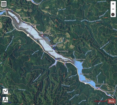
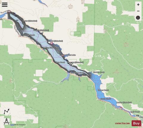
Lookout Point Lake (also Lookout Point Reservoir) is a large reservoir on the Middle Fork Willamette River in Lane County, Oregon, United States. It was created in 1953 with the construction of Lookout Point Dam. The downstream end of the reservoir is about 20 miles (32 km) southeast of Eugene. It lies immediately upriver from Dexter Lake, another reservoir. The city of Lowell is nearby, along the north shore of Dexter Lake. Oregon Route 58 follows the lake's southern shore and Boundary Road the northern shore. The lake, about 10 miles (16 km) long, continues upriver to within about 7 miles (11 km) of Oakridge. Lookout Point Dam, 276 feet (84 m) high, impounds up to 477,700 acre-feet (589,200,000 m3) of water. It helps control flooding, generates electricity, and provides a place for boating and other outdoor recreation.
More on Wikipedia...Popular fish species in this lake include Rainbow trout.
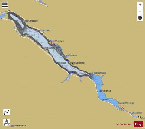
Lookout Point Lake Fishing Map Stats | |
| Title | Lookout Point Lake |
| Scale | 1:12000 |
| Counties | Lane |
| Nearby Cities | Lowell, Dexter, Westfir, Oakridge, Walterville, Disston, Leaburg, Dorena, Culp Creek, Goshen |
| Area * | 4158.67 acres |
| Shoreline * | 34.50 miles |
| Min Longitude | -122.75 |
| Min Latitude | 43.81 |
| Max Longitude | -122.57 |
| Max Latitude | 43.92 |
| Edition Label 1 | |
| Edition Label 2 | |
| Edition Label 3 | |
| Id | US_OR_ordfw_lookout_point_lake |
| Country | US |
| Projection | Mercator |
| * some Stats may include nearby/connecting waterbodies | |
|