East Lake fishing map is available as part of iBoating : USA Marine & Fishing App(now supported on multiple platforms including Android, iPhone/iPad, MacBook, and Windows(tablet and phone)/PC based chartplotter.).
With our Lake Maps App, you get all the great marine chart app features like fishing spots, along with East Lake depth map. The fishing maps app include HD lake depth contours, along with advanced features found in Fish Finder / Gps Chart Plotter systems, turning your device into a Depth Finder. The East Lake Navigation App provides advanced features of a Marine Chartplotter including adjusting water level offset and custom depth shading. Fishing spots and depth contours layers are available in most Lake maps. Lake navigation features include advanced instrumentation to gather wind speed direction, water temperature, water depth, and accurate GPS with AIS receivers(using NMEA over TCP/UDP). Autopilot support can be enabled during ‘Goto WayPoint’ and ‘Route Assistance’.
Now i-Boating supports Fishing Points in East Lake.
Have more questions about the Nautical Chart App? Ask us.
Fishing Info for East Lake
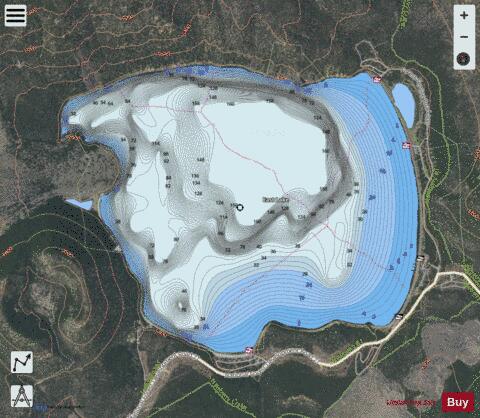
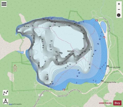
East Lake is one of the twin lakes that occupy part of the Newberry Crater or caldera in Central Oregon, United States. It is located in the Deschutes National Forest near the city of La Pine. The caldera was formed over 500,000 years ago from volcanic eruptions. East Lake's water comes from snow melt, rain fall, and hot springs only. The average depth is 67 feet (20 m), 180 feet (55 m) at the deepest point, and covers 1,044 acres (4.2 km2). East Lake is about 50 feet (15 m) higher in elevation and is to the east of its twin, Paulina Lake. East Lake has two main camping grounds along the lake shore as well as East Lake Resort. The resort has cabins and boats for rent as well as a general store.The lake offers fishing for brown trout and rainbow trout. The lake is stocked with sockeye salmon (Kokanee) and Atlantic salmon.
More on Wikipedia...Popular fish species in this lake include Atlantic salmon and Rainbow trout.
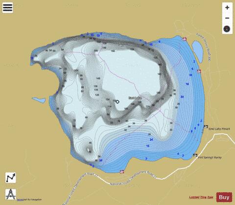
East Lake Fishing Map Stats | |
| Title | East Lake |
| Scale | 1:6000 |
| Counties | Deschutes |
| Nearby Cities | La Pine, Bend, Alfalfa, Tumalo, Gilchrist, Redmond, Crescent, Powell Butte, Brothers, Silver Lake |
| Area * | 979.21 acres |
| Shoreline * | 5.96 miles |
| Min Longitude | -121.23 |
| Min Latitude | 43.72 |
| Max Longitude | -121.20 |
| Max Latitude | 43.74 |
| Edition Label 1 | |
| Edition Label 2 | |
| Edition Label 3 | |
| Id | US_OR_ordfw_east_lake |
| Country | US |
| Projection | Mercator |
| * some Stats may include nearby/connecting waterbodies | |
|