Back Lake fishing map is available as part of iBoating : USA Marine & Fishing App(now supported on multiple platforms including Android, iPhone/iPad, MacBook, and Windows(tablet and phone)/PC based chartplotter.).
With our Lake Maps App, you get all the great marine chart app features like fishing spots, along with Back Lake depth map. The fishing maps app include HD lake depth contours, along with advanced features found in Fish Finder / Gps Chart Plotter systems, turning your device into a Depth Finder. The Back Lake Navigation App provides advanced features of a Marine Chartplotter including adjusting water level offset and custom depth shading. Fishing spots and depth contours layers are available in most Lake maps. Lake navigation features include advanced instrumentation to gather wind speed direction, water temperature, water depth, and accurate GPS with AIS receivers(using NMEA over TCP/UDP). Autopilot support can be enabled during ‘Goto WayPoint’ and ‘Route Assistance’.
Now i-Boating supports Fishing Points in Back Lake.
Have more questions about the Nautical Chart App? Ask us.
Fishing Info for Back Lake
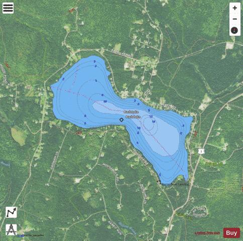
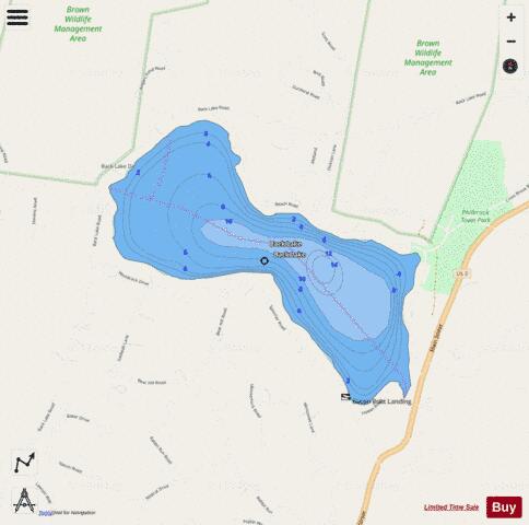
Back Lake is a 348-acre (141 ha) water body located in Coos County in northern New Hampshire, United States, in the town of Pittsburg. It is part of the Connecticut River watershed. It is situated north of Lake Francis and west of First Connecticut Lake. U.S. Route 3 passes by Back Lake's eastern shore. The lake is classified as a coldwater fishery, with observed species including brook trout, rainbow trout, brown trout, and brown bullhead. There are numerous cabins around the lake, and two public boat launch locations. Boats on the lake are generally restricted to a maximum speed of 10 miles per hour (16 km/h), and skicraft have been banned since 2004.
More on Wikipedia...Popular fish species in this lake include Brook trout, Brown bullhead and Rainbow trout.
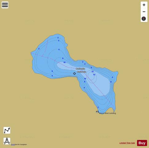
Back Lake Fishing Map Stats | |
| Title | Back Lake |
| Scale | 1:3000 |
| Counties | Coos |
| Nearby Cities | Pittsburg, Beecher Falls, Stewartstown, West Stewartstown, Canaan, Colebrook, Columbia, Wilsons Mills, Errol, North Stratford |
| Area * | 347.37 acres |
| Shoreline * | 4.04 miles |
| Min Longitude | -71.36 |
| Min Latitude | 45.07 |
| Max Longitude | -71.34 |
| Max Latitude | 45.09 |
| Edition Label 1 | |
| Edition Label 2 | |
| Edition Label 3 | |
| Id | US_NH_01775813 |
| Country | US |
| Projection | Mercator |
| * some Stats may include nearby/connecting waterbodies | |
|