Longview Lake fishing map is available as part of iBoating : USA Marine & Fishing App(now supported on multiple platforms including Android, iPhone/iPad, MacBook, and Windows(tablet and phone)/PC based chartplotter.).
With our Lake Maps App, you get all the great marine chart app features like fishing spots, along with Longview Lake depth map. The fishing maps app include HD lake depth contours, along with advanced features found in Fish Finder / Gps Chart Plotter systems, turning your device into a Depth Finder. The Longview Lake Navigation App provides advanced features of a Marine Chartplotter including adjusting water level offset and custom depth shading. Fishing spots and depth contours layers are available in most Lake maps. Lake navigation features include advanced instrumentation to gather wind speed direction, water temperature, water depth, and accurate GPS with AIS receivers(using NMEA over TCP/UDP). Autopilot support can be enabled during ‘Goto WayPoint’ and ‘Route Assistance’.
Now i-Boating supports Fishing Points in Longview Lake.
Have more questions about the Nautical Chart App? Ask us.
Fishing Info for Longview Lake
Longview Lake is a 930-acre (3.8 km2) freshwater reservoir in parts of Kansas City, Lee's Summit, and Grandview, all in Jackson County, Missouri. The reservoir is part of U.S. Army Corps of Engineers Little Blue River Project for flood control, recreation, and fish and wildlife conservation. The lake is located in the 4,852-acre (20 km2) Longview Lake Park, which is managed by Jackson County Parks and Recreation.
More on Wikipedia...Popular fish species in this lake include Crappie and Largemouth bass.
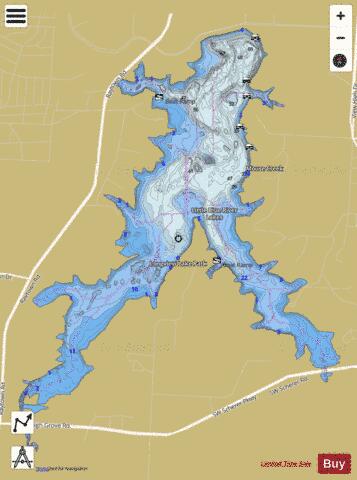
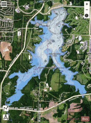
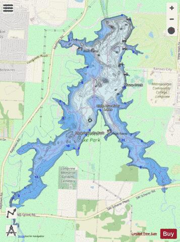
Longview Lake Fishing Map Stats | |
| Title | Longview Lake |
| Scale | 1:6000 |
| Counties | Jackson |
| Nearby Cities | Grandview, Unity Village, Lee's Summit, Belton, Raytown, Raymore, Lake Winnebago, Greenwood, Loch Lloyd, Kenneth |
| Area * | 953.92 acres |
| Shoreline * | 17.69 miles |
| Min Longitude | -94.49 |
| Min Latitude | 38.88 |
| Max Longitude | -94.45 |
| Max Latitude | 38.92 |
| Edition Label 1 | |
| Edition Label 2 | |
| Edition Label 3 | |
| Id | US_MO_longview_lake |
| Country | US |
| Projection | Mercator |
| * some Stats may include nearby/connecting waterbodies | |
|