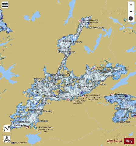
Burntside fishing map is available as part of iBoating : USA Marine & Fishing App(now supported on multiple platforms including Android, iPhone/iPad, MacBook, and Windows(tablet and phone)/PC based chartplotter.).
With our Lake Maps App, you get all the great marine chart app features like fishing spots, along with Burntside lake depth map. The fishing maps app include HD lake depth contours, along with advanced features found in Fish Finder / Gps Chart Plotter systems, turning your device into a Depth Finder. The Burntside Navigation App provides advanced features of a Marine Chartplotter including adjusting water level offset and custom depth shading. Fishing spots and depth contours layers are available in most Lake maps. Lake navigation features include advanced instrumentation to gather wind speed direction, water temperature, water depth, and accurate GPS with AIS receivers(using NMEA over TCP/UDP). Autopilot support can be enabled during ‘Goto WayPoint’ and ‘Route Assistance’.
Now i-Boating supports Fishing Points in Burntside.
Have more questions about the Nautical Chart App? Ask us.
Fishing Info for Burntside
Burntside Lake is a 7,139-acre (28.89 km2) lake, located 3 miles (4.8 km) northwest of Ely, Minnesota, in Saint Louis County, Minnesota. Its western boundary adjoins the Boundary Waters Canoe Area Wilderness on Tamarack Creek. Native fish include Bluegill, Golden Shiner, Green Sunfish, Lake Trout, Lake Whitefish, Northern Pike, Rainbow Smelt, Rock Bass, Shorthead Redhorse, Smallmouth Bass, Walleye, White Sucker and Yellow Perch. On its shores are two historic resorts with original hand-scribed log cabins, both built in the early 1900s and operating continuously since then: Burntside Lodge (1913) and Camp Van Vac (1918). The YMCA's Camp Widjiwagan is also located on the lake's shore. Burntside Lake's more than 100 islands include Beach;Bear;Berry; Blueberry;Brownell;Burnt;Burntside Islands;Gem;Dollar; Evans; Good Dog;Half Dollar; Honeymoon; Indian;Lockhart;Long;Lost Girl; Miller; Oliver;Picnic;Porkchop;Ripple;Snake; State; Sumpter; Waters; and many more. Long Island was recently acquired by the Trust for Public Land. The Burntside Islands (Snellman and Pine) are SNAs (Scientific and Natural Areas, gifted by the Nature Conservancy) held by the DNR.
More on Wikipedia...Popular fish species in this lake include Walleye.
Burntside Fishing Map Stats | |
| Title | Burntside |
| Scale | 1:12000 |
| Counties | St. Louis |
| Nearby Cities | Ely, Winton, Soudan, Babbitt, Tower, Embarrass, Hoyt Lakes, Aurora, Biwabik, Buyck |
| Area * | 7318.71 acres |
| Shoreline * | 103.50 miles |
| Min Longitude | -92.06 |
| Min Latitude | 47.89 |
| Max Longitude | -91.89 |
| Max Latitude | 48.00 |
| Edition Label 1 | |
| Edition Label 2 | |
| Edition Label 3 | |
| Id | US_MN_69011800 |
| Country | US |
| Projection | Mercator |
| * some Stats may include nearby/connecting waterbodies | |
|


