Cedar fishing map is available as part of iBoating : USA Marine & Fishing App(now supported on multiple platforms including Android, iPhone/iPad, MacBook, and Windows(tablet and phone)/PC based chartplotter.).
With our Lake Maps App, you get all the great marine chart app features like fishing spots, along with Cedar lake depth map. The fishing maps app include HD lake depth contours, along with advanced features found in Fish Finder / Gps Chart Plotter systems, turning your device into a Depth Finder. The Cedar Navigation App provides advanced features of a Marine Chartplotter including adjusting water level offset and custom depth shading. Fishing spots and depth contours layers are available in most Lake maps. Lake navigation features include advanced instrumentation to gather wind speed direction, water temperature, water depth, and accurate GPS with AIS receivers(using NMEA over TCP/UDP). Autopilot support can be enabled during ‘Goto WayPoint’ and ‘Route Assistance’.
Now i-Boating supports Fishing Points in Cedar.
Have more questions about the Nautical Chart App? Ask us.
Fishing Info for Cedar
Cedar Lake is a lake in McLeod and Meeker counties, in the U.S. state of Minnesota. Cedar Lake was named for the red cedar trees near the lake.Although Cedar Lake is a large lake (1,860 acres) it is also quite shallow lake reaching only 8 feet (2.4 m) deep. The bottom of the lake consists of silt and detritus and has abundant curly-leaf pondweed in the spring months before it dies back in July. The lake has a history of and there is fish migration from nearby Belle Lake. The lake has abundant common carp and black bullheads as well as moderate numbers of northern pike and black crappie.
More on Wikipedia...Popular fish species in this lake include Black bullhead, Black crappie, Common carp and Northern pike.
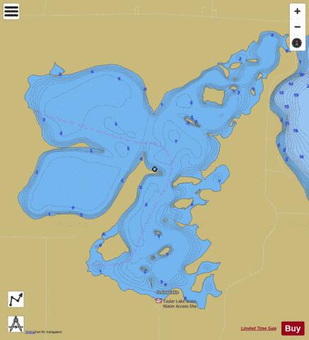
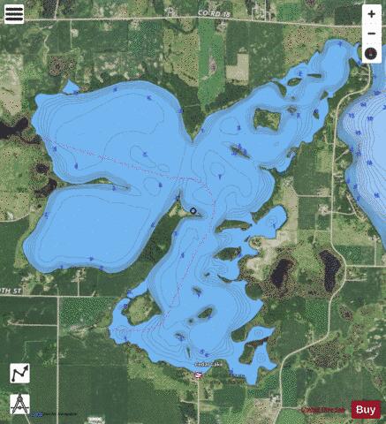
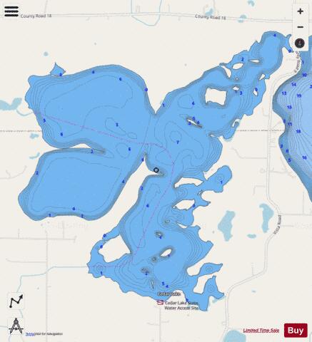
Cedar Fishing Map Stats | |
| Title | Cedar |
| Scale | 1:6000 |
| Counties | McLeod, Meeker |
| Nearby Cities | Cedar Mills, Hutchinson, Darwin, Litchfield, Dassel, Cosmos, Forest City, Biscay, Rosendale, Stewart |
| Area * | 1860.93 acres |
| Shoreline * | 22.96 miles |
| Min Longitude | -94.49 |
| Min Latitude | 44.96 |
| Max Longitude | -94.44 |
| Max Latitude | 44.99 |
| Edition Label 1 | |
| Edition Label 2 | |
| Edition Label 3 | |
| Id | US_MN_43011500 |
| Country | US |
| Projection | Mercator |
| * some Stats may include nearby/connecting waterbodies | |
|