Big Sandy fishing map is available as part of iBoating : USA Marine & Fishing App(now supported on multiple platforms including Android, iPhone/iPad, MacBook, and Windows(tablet and phone)/PC based chartplotter.).
With our Lake Maps App, you get all the great marine chart app features like fishing spots, along with Big Sandy lake depth map. The fishing maps app include HD lake depth contours, along with advanced features found in Fish Finder / Gps Chart Plotter systems, turning your device into a Depth Finder. The Big Sandy Navigation App provides advanced features of a Marine Chartplotter including adjusting water level offset and custom depth shading. Fishing spots and depth contours layers are available in most Lake maps. Lake navigation features include advanced instrumentation to gather wind speed direction, water temperature, water depth, and accurate GPS with AIS receivers(using NMEA over TCP/UDP). Autopilot support can be enabled during ‘Goto WayPoint’ and ‘Route Assistance’.
Now i-Boating supports Fishing Points in Big Sandy.
Have more questions about the Nautical Chart App? Ask us.
Fishing Info for Big Sandy
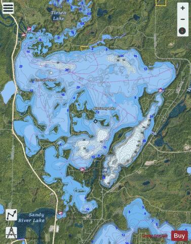
Big Sandy Lake is a lake in Aitkin County, Minnesota, approximately nine miles north of McGregor. The lake is considered fertile walleye ground with several habitat types, including the open main basin, the deep, cold eastern basin, and a shallow, more isolated south basin. Shallow bays containing dense beds of wild rice are found on south, west, and northwest sides of the lake. Public access is provided by the Minnesota Department of Natural Resources at two locations, the first on the Sandy River north of the "Pier 65" bridge, and the second on the northeast side of the lake. Additional points of access are maintained by the Corps of Engineers and Shamrock Township.
More on Wikipedia...Popular fish species in this lake include Walleye.
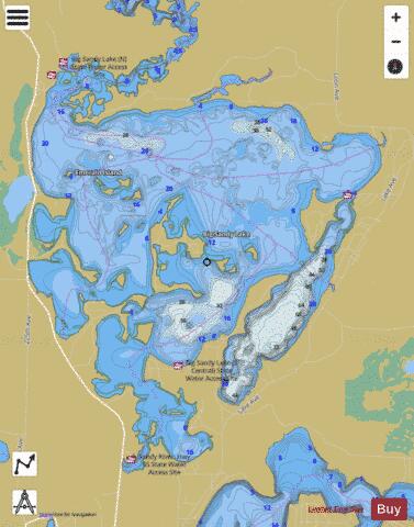
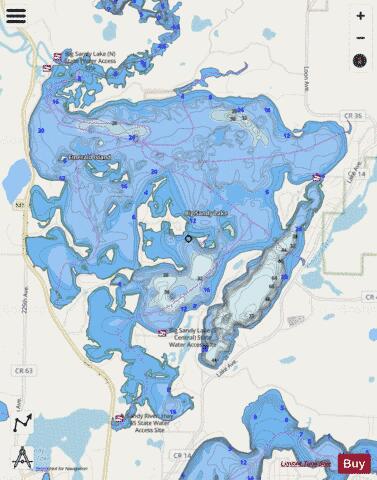
Big Sandy Fishing Map Stats | |
| Title | Big Sandy |
| Scale | 1:12000 |
| Counties | Aitkin |
| Nearby Cities | Sheshebee, McGregor, Tamarack, Palisade, East Lake, Jacobson, Lawler, Kimberly, Wright, Wawina |
| Area * | 6113.39 acres |
| Shoreline * | 63.49 miles |
| Min Longitude | -93.33 |
| Min Latitude | 46.72 |
| Max Longitude | -93.24 |
| Max Latitude | 46.79 |
| Edition Label 1 | |
| Edition Label 2 | |
| Edition Label 3 | |
| Id | US_MN_01006200 |
| Country | US |
| Projection | Mercator |
| * some Stats may include nearby/connecting waterbodies | |
|