Williams Lake fishing map is available as part of iBoating : USA Marine & Fishing App(now supported on multiple platforms including Android, iPhone/iPad, MacBook, and Windows(tablet and phone)/PC based chartplotter.).
With our Lake Maps App, you get all the great marine chart app features like fishing spots, along with Williams Lake depth map. The fishing maps app include HD lake depth contours, along with advanced features found in Fish Finder / Gps Chart Plotter systems, turning your device into a Depth Finder. The Williams Lake Navigation App provides advanced features of a Marine Chartplotter including adjusting water level offset and custom depth shading. Fishing spots and depth contours layers are available in most Lake maps. Lake navigation features include advanced instrumentation to gather wind speed direction, water temperature, water depth, and accurate GPS with AIS receivers(using NMEA over TCP/UDP). Autopilot support can be enabled during ‘Goto WayPoint’ and ‘Route Assistance’.
Now i-Boating supports Fishing Points in Williams Lake.
Have more questions about the Nautical Chart App? Ask us.
Fishing Info for Williams Lake
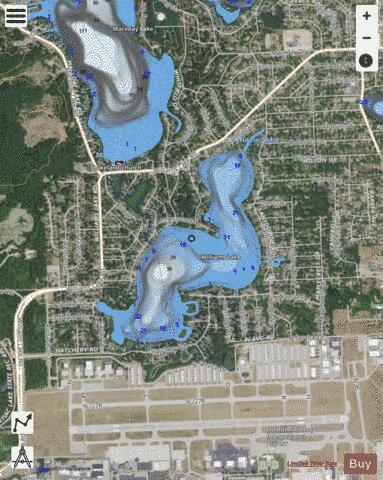
Williams Lake is a 155-acre all-sports lake in Waterford Township in Oakland County, Michigan in the Clinton River watershed. The lake lies north of the Oakland County International Airport, to the west of Airport Road, and to the south and east of Williams Lake Road. Williams Lake connects upstream to Maceday Lake.
More on Wikipedia...Popular fish species in this lake include Crappie, Largemouth bass and Northern pike.
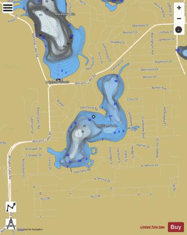
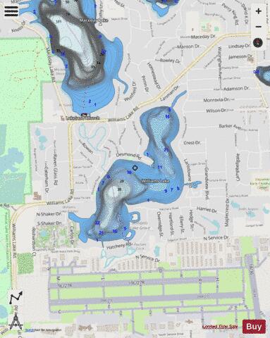
Williams Lake Fishing Map Stats | |
| Title | Williams Lake |
| Scale | 1:6000 |
| Includes Data from Fish Atlas | Yes |
| Counties | Oakland |
| Nearby Cities | Waterford, The Village of Clarkston, Clarkston, Union Lake, Westacres, Orchard Lake Village, Keego Harbor, Commerce, Lake Angelus, Sylvan Lake |
| Area * | 169.50 acres |
| Shoreline * | 4.45 miles |
| Min Longitude | -83.43 |
| Min Latitude | 42.67 |
| Max Longitude | -83.42 |
| Max Latitude | 42.68 |
| Edition Label 1 | |
| Edition Label 2 | |
| Edition Label 3 | |
| Id | US_MI_oakmich_williams_lake |
| Country | US |
| Projection | Mercator |
| * some Stats may include nearby/connecting waterbodies | |
|