Hell Roaring Lake fishing map is available as part of iBoating : USA Marine & Fishing App(now supported on multiple platforms including Android, iPhone/iPad, MacBook, and Windows(tablet and phone)/PC based chartplotter.).
With our Lake Maps App, you get all the great marine chart app features like fishing spots, along with Hell Roaring Lake depth map. The fishing maps app include HD lake depth contours, along with advanced features found in Fish Finder / Gps Chart Plotter systems, turning your device into a Depth Finder. The Hell Roaring Lake Navigation App provides advanced features of a Marine Chartplotter including adjusting water level offset and custom depth shading. Fishing spots and depth contours layers are available in most Lake maps. Lake navigation features include advanced instrumentation to gather wind speed direction, water temperature, water depth, and accurate GPS with AIS receivers(using NMEA over TCP/UDP). Autopilot support can be enabled during ‘Goto WayPoint’ and ‘Route Assistance’.
Now i-Boating supports Fishing Points in Hell Roaring Lake.
Have more questions about the Nautical Chart App? Ask us.
Fishing Info for Hell Roaring Lake
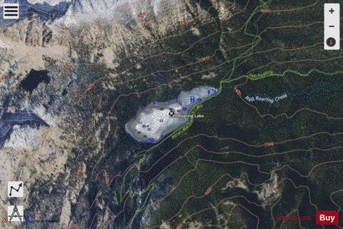
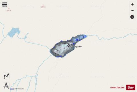
Hell Roaring Lake is an alpine lake in Custer County, Idaho, United States, located in the Sawtooth Mountains in the Sawtooth National Recreation Area. The lake is approximately 13.3 miles (21.4 km) southwest of Stanley. The lake can be accessed from State Highway 75 in the Sawtooth Valley. There is a trailhead about two miles from the lake on Sawtooth National Forest road 097, which is a high clearance road. There is another trailhead about two miles further downstream along forest road 210 for those who cannot drive road 097 as well as horses. Hell Roaring Lake is in the Sawtooth Wilderness and wilderness permit can be obtained at trailheads. The lake is surrounded by the Finger of Fate at 9,775 feet (2,979 m) and other peaks. Upstream of Hell Roaring Lake is Imogene Lake, Profile Lake, Mushroom Lake, and Lucille Lake. * Hell Roaring Lake * Hell Roaring Lake * Hell Roaring Lake * Hell Roaring Lake * Hell Roaring Creek
More on Wikipedia...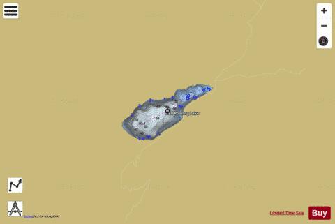
Hell Roaring Lake Fishing Map Stats | |
| Title | Hell Roaring Lake |
| Scale | 1:3000 |
| Counties | Custer |
| Nearby Cities | Stanley, Atlanta, Sunbeam, Featherville, Clayton, Pine, Ketchum, Sun Valley, Lowman, Fairfield |
| Area * | 56.59 acres |
| Shoreline * | 1.48 miles |
| Min Longitude | -114.94 |
| Min Latitude | 44.02 |
| Max Longitude | -114.93 |
| Max Latitude | 44.03 |
| Edition Label 1 | |
| Edition Label 2 | |
| Edition Label 3 | |
| Id | US_LM_CC_us_id_cu_08n13e_hell_roaring |
| Country | US |
| Projection | Mercator |
| * some Stats may include nearby/connecting waterbodies | |
|