Catahoula Lake fishing map is available as part of iBoating : USA Marine & Fishing App(now supported on multiple platforms including Android, iPhone/iPad, MacBook, and Windows(tablet and phone)/PC based chartplotter.).
With our Lake Maps App, you get all the great marine chart app features like fishing spots, along with Catahoula Lake depth map. The fishing maps app include HD lake depth contours, along with advanced features found in Fish Finder / Gps Chart Plotter systems, turning your device into a Depth Finder. The Catahoula Lake Navigation App provides advanced features of a Marine Chartplotter including adjusting water level offset and custom depth shading. Fishing spots and depth contours layers are available in most Lake maps. Lake navigation features include advanced instrumentation to gather wind speed direction, water temperature, water depth, and accurate GPS with AIS receivers(using NMEA over TCP/UDP). Autopilot support can be enabled during ‘Goto WayPoint’ and ‘Route Assistance’.
Now i-Boating supports Fishing Points in Catahoula Lake.
Have more questions about the Nautical Chart App? Ask us.
Fishing Info for Catahoula Lake
Catahoula Lake (French: Lac Catahoula) is a large freshwater lake located in LaSalle Parish and Rapides Parish of central Louisiana, United States. Catahoula Lake is the largest natural freshwater lake in the state covering just over 46 square miles (120 km2). It is owned by the State of Louisiana and managed by the U.S. Army Corps of Engineers, the U.S. Fish and Wildlife Service, and the Louisiana Department of Wildlife and Fisheries. Catahoula is a shallow, and poorly drained wetland supported by the Little River and several creeks. It was drained by the Old River, and a number of bayous until several flood control projects changed the lake's drainage characteristics. It is known as the largest moist soil unit in North America and supports a variety of waterfowl including geese, duck, and wading birds and is a recreational area for hunting, fishing, hiking, sight seeing, and bird watching. Access to the lake is limited on the western shores due to private and corporate fencing.
More on Wikipedia...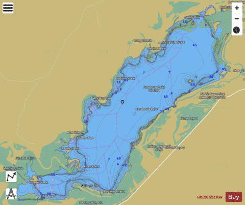
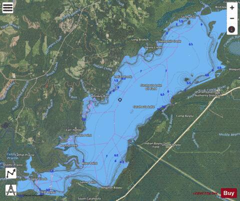
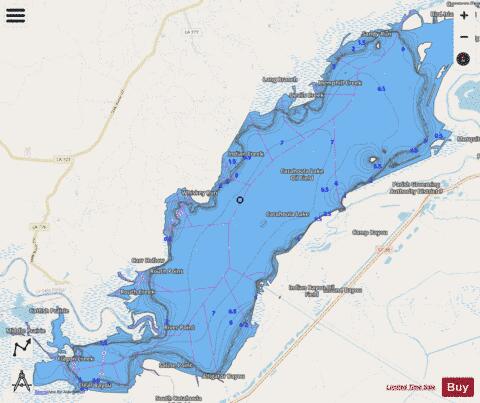
Catahoula Lake Fishing Map Stats | |
| Title | Catahoula Lake |
| Scale | 1:6000 |
| Counties | LaSalle, Rapides |
| Nearby Cities | Walters, Whitehall, Nebo, Rogers, Archie, Deville, Jena, Midway, Libuse, Manifest |
| Area * | 18204.98 acres |
| Shoreline * | 75.50 miles |
| Min Longitude | -92.22 |
| Min Latitude | 31.45 |
| Max Longitude | -92.04 |
| Max Latitude | 31.58 |
| Edition Label 1 | |
| Edition Label 2 | |
| Edition Label 3 | |
| Id | US_LA_00553925 |
| Country | US |
| Projection | Mercator |
| * some Stats may include nearby/connecting waterbodies | |
|