Lone Star Lake fishing map is available as part of iBoating : USA Marine & Fishing App(now supported on multiple platforms including Android, iPhone/iPad, MacBook, and Windows(tablet and phone)/PC based chartplotter.).
With our Lake Maps App, you get all the great marine chart app features like fishing spots, along with Lone Star Lake depth map. The fishing maps app include HD lake depth contours, along with advanced features found in Fish Finder / Gps Chart Plotter systems, turning your device into a Depth Finder. The Lone Star Lake Navigation App provides advanced features of a Marine Chartplotter including adjusting water level offset and custom depth shading. Fishing spots and depth contours layers are available in most Lake maps. Lake navigation features include advanced instrumentation to gather wind speed direction, water temperature, water depth, and accurate GPS with AIS receivers(using NMEA over TCP/UDP). Autopilot support can be enabled during ‘Goto WayPoint’ and ‘Route Assistance’.
Now i-Boating supports Fishing Points in Lone Star Lake.
Have more questions about the Nautical Chart App? Ask us.
Fishing Info for Lone Star Lake
Lone Star Lake is a 185-acre (75 ha) lake located in Douglas County, in the U.S. state of Kansas. The lake lies to the southwest of the unincorporated community of Lone Star, Kansas. Lone Star Lake Park surrounds the lake and offers camping, picnic shelters, and a swimming beach. The lake and park are owned and operated by Douglas County. The Civilian Lone Star Lake Park Conservation Corps began construction of the lake in 1934 for the Forestry Fish and Game Commission. Unable to continue financing construction, the Commission transferred the Lone Star Lake Project to Douglas County in 1937. The lake was completed in 1939. The Clean Lakes Act provided for rehabilitation in 1981, including shoreline restoration and improving water quality. The spillway was completely reconstructed beginning in 2000 due to severe erosion.
More on Wikipedia...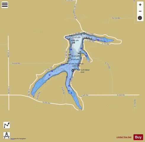
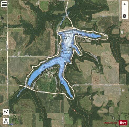
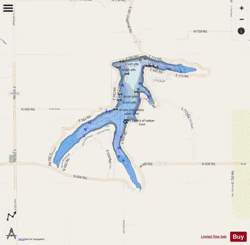
Lone Star Lake Fishing Map Stats | |
| Title | Lone Star Lake |
| Scale | 1:3000 |
| Counties | Douglas |
| Nearby Cities | Lone Star, Clinton, Pleasant Grove, Centropolis, Stull, Richland, Overbrook, Vinland, Lawrence, Baldwin City |
| Area * | 177.55 acres |
| Shoreline * | 5.76 miles |
| Min Longitude | -95.39 |
| Min Latitude | 38.82 |
| Max Longitude | -95.37 |
| Max Latitude | 38.84 |
| Edition Label 1 | |
| Edition Label 2 | |
| Edition Label 3 | |
| Id | US_KS_lone_star_lake_douglas |
| Country | US |
| Projection | Mercator |
| * some Stats may include nearby/connecting waterbodies | |
|