DOCTORS LAKE fishing map is available as part of iBoating : USA Marine & Fishing App(now supported on multiple platforms including Android, iPhone/iPad, MacBook, and Windows(tablet and phone)/PC based chartplotter.).
With our Lake Maps App, you get all the great marine chart app features like fishing spots, along with DOCTORS LAKE depth map. The fishing maps app include HD lake depth contours, along with advanced features found in Fish Finder / Gps Chart Plotter systems, turning your device into a Depth Finder. The DOCTORS LAKE Navigation App provides advanced features of a Marine Chartplotter including adjusting water level offset and custom depth shading. Fishing spots and depth contours layers are available in most Lake maps. Lake navigation features include advanced instrumentation to gather wind speed direction, water temperature, water depth, and accurate GPS with AIS receivers(using NMEA over TCP/UDP). Autopilot support can be enabled during ‘Goto WayPoint’ and ‘Route Assistance’.
Now i-Boating supports Fishing Points in DOCTORS LAKE.
Have more questions about the Nautical Chart App? Ask us.
Fishing Info for DOCTORS LAKE
Doctors Lake is a body of water located off the St. Johns River in Clay County, Florida. Despite its name, it is not a true lake, as it is actually an inlet, openly connected to the St. Johns. Because of the estuarine nature of the St. Johns, Doctors Lake is itself somewhat brackish. Many docks border the lake for recreational activity such as boating, fishing and waterskiing. To the south, the lake splits in half into two small creeks that flow from swampland.
More on Wikipedia...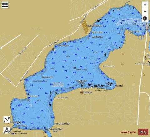
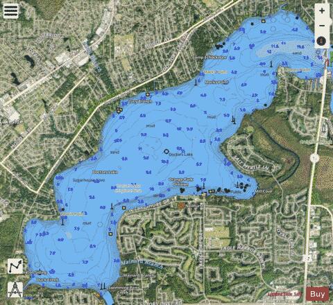
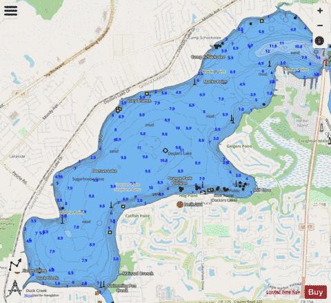
DOCTORS LAKE Fishing Map Stats | |
| Title | DOCTORS LAKE |
| Scale | 1:12000 |
| 1 ft Depth Contours for Anglers | Yes |
| Counties | Clay |
| Nearby Cities | Doctors Inlet, Orange Park, Meadowbrook Terrace, Russell, Fruit Cove, Middleburg, Penney Farms, Green Cove Springs, Jacksonville, Durbin |
| Area * | 3433.19 acres |
| Shoreline * | 17.94 miles |
| Min Longitude | -81.77 |
| Min Latitude | 30.10 |
| Max Longitude | -81.70 |
| Max Latitude | 30.16 |
| Edition Label 1 | |
| Edition Label 2 | |
| Edition Label 3 | |
| Id | US_FL_00281632 |
| Country | US |
| Projection | Mercator |
| * some Stats may include nearby/connecting waterbodies | |
|