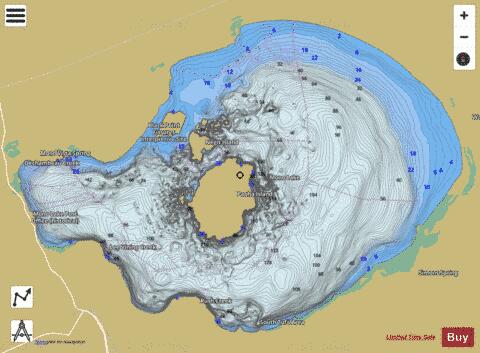
Mono Lake fishing map is available as part of iBoating : USA Marine & Fishing App(now supported on multiple platforms including Android, iPhone/iPad, MacBook, and Windows(tablet and phone)/PC based chartplotter.).
With our Lake Maps App, you get all the great marine chart app features like fishing spots, along with Mono Lake depth map. The fishing maps app include HD lake depth contours, along with advanced features found in Fish Finder / Gps Chart Plotter systems, turning your device into a Depth Finder. The Mono Lake Navigation App provides advanced features of a Marine Chartplotter including adjusting water level offset and custom depth shading. Fishing spots and depth contours layers are available in most Lake maps. Lake navigation features include advanced instrumentation to gather wind speed direction, water temperature, water depth, and accurate GPS with AIS receivers(using NMEA over TCP/UDP). Autopilot support can be enabled during ‘Goto WayPoint’ and ‘Route Assistance’.
Now i-Boating supports Fishing Points in Mono Lake.
Have more questions about the Nautical Chart App? Ask us.
Fishing Info for Mono Lake
Mono Lake (/ˈmoʊnoʊ/ MOH-noh) is a saline soda lake in Mono County, California, formed at least 760,000 years ago as a terminal lake in an endorheic basin. The lack of an outlet causes high levels of salts to accumulate in the lake which make its water alkaline. The desert lake has an unusually productive ecosystem based on brine shrimp, which thrive in its waters, and provides critical habitat for two million annual migratory birds that feed on the shrimp and alkali flies (Ephydra hians). Historically, the native Kutzadika'a people ate the alkali flies' pupae, which live in the shallow waters around the edge of the lake. When the city of Los Angeles diverted water from the freshwater streams flowing into the lake, it lowered the lake level, which imperiled the migratory birds. The Mono Lake Committee formed in response and won a legal battle that forced Los Angeles to partially replenish the lake level.
More on Wikipedia...Mono Lake Fishing Map Stats | |
| Title | Mono Lake |
| Scale | 1:12000 |
| Counties | Mono |
| Nearby Cities | Lee Vining, June Lake, Bridgeport, Mammoth Lakes, Benton, Aspen Springs, Toms Place, Yosemite Village, Hawthorne, Babbitt |
| Area * | 45298.68 acres |
| Shoreline * | 67.83 miles |
| Min Longitude | -119.15 |
| Min Latitude | 37.94 |
| Max Longitude | -118.91 |
| Max Latitude | 38.08 |
| Edition Label 1 | |
| Edition Label 2 | |
| Edition Label 3 | |
| Id | US_CA_00263749 |
| Country | US |
| Projection | Mercator |
| * some Stats may include nearby/connecting waterbodies | |
|


