Lake Berryessa fishing map is available as part of iBoating : USA Marine & Fishing App(now supported on multiple platforms including Android, iPhone/iPad, MacBook, and Windows(tablet and phone)/PC based chartplotter.).
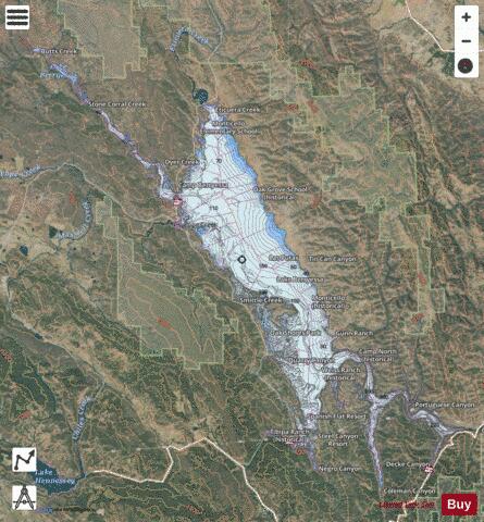
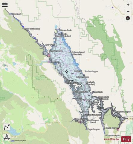
With our Lake Maps App, you get all the great marine chart app features like fishing spots, along with Lake Berryessa depth map. The fishing maps app include HD lake depth contours, along with advanced features found in Fish Finder / Gps Chart Plotter systems, turning your device into a Depth Finder. The Lake Berryessa Navigation App provides advanced features of a Marine Chartplotter including adjusting water level offset and custom depth shading. Fishing spots and depth contours layers are available in most Lake maps. Lake navigation features include advanced instrumentation to gather wind speed direction, water temperature, water depth, and accurate GPS with AIS receivers(using NMEA over TCP/UDP). Autopilot support can be enabled during ‘Goto WayPoint’ and ‘Route Assistance’.
Now i-Boating supports Fishing Points in Lake Berryessa.
Have more questions about the Nautical Chart App? Ask us.
Fishing Info for Lake Berryessa
Lake Berryessa is the largest lake in Napa County, California. This reservoir in the Vaca Mountains was formed following the construction of the Monticello Dam on Putah Creek in the 1950s. Since the early 1960s, this reservoir has provided water and hydroelectricity to the North Bay region of the San Francisco Bay Area. The reservoir was named after the first European settlers in the Berryessa Valley, José Jesús and Sexto "Sisto" Berrelleza (a Basque surname, Anglicized to "Berreyesa", then later respelled "Berryessa"), who were granted Rancho Las Putas in 1843.
More on Wikipedia...Popular fish species in this lake include Brook trout, Crappie, Largemouth bass, Rainbow trout, Sacramento pikeminnow, Smallmouth bass, Spotted bass and Threadfin shad.
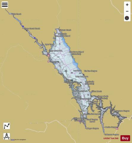
Lake Berryessa Fishing Map Stats | |
| Title | Lake Berryessa |
| Scale | 1:12000 |
| Counties | Napa |
| Nearby Cities | Pope Valley, Winters, Angwin, Silverado Resort, Yountville, Guinda, Allendale, Oakville, Hartley, Hidden Valley Lake |
| Area * | 18677.09 acres |
| Shoreline * | 158.71 miles |
| Min Longitude | -122.39 |
| Min Latitude | 38.48 |
| Max Longitude | -122.10 |
| Max Latitude | 38.71 |
| Edition Label 1 | |
| Edition Label 2 | |
| Edition Label 3 | |
| Id | US_CA_00255067 |
| Country | US |
| Projection | Mercator |
| * some Stats may include nearby/connecting waterbodies | |
|