Clark, Lake fishing map is available as part of iBoating : USA Marine & Fishing App(now supported on multiple platforms including Android, iPhone/iPad, MacBook, and Windows(tablet and phone)/PC based chartplotter.).
With our Lake Maps App, you get all the great marine chart app features like fishing spots, along with Clark, Lake depth map. The fishing maps app include HD lake depth contours, along with advanced features found in Fish Finder / Gps Chart Plotter systems, turning your device into a Depth Finder. The Clark, Lake Navigation App provides advanced features of a Marine Chartplotter including adjusting water level offset and custom depth shading. Fishing spots and depth contours layers are available in most Lake maps. Lake navigation features include advanced instrumentation to gather wind speed direction, water temperature, water depth, and accurate GPS with AIS receivers(using NMEA over TCP/UDP). Autopilot support can be enabled during ‘Goto WayPoint’ and ‘Route Assistance’.
Now i-Boating supports Fishing Points in Clark, Lake.
Have more questions about the Nautical Chart App? Ask us.
Fishing Info for Clark, Lake
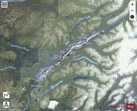
Lake Clark (Dena'ina: Qizhjeh Vena) is a lake in southwest Alaska. It drains through Six Mile Lake and the Newhalen River into Iliamna Lake. The lake is about 64 km (40 mi) long and about 8 km (5.0 mi) wide. Lake Clark was named for John W. Clark, chief of the Nushagak trading post and the first American non-Native to see the lake, when an expedition financed by a weekly magazine reached it in February 1891. The Dena'ina Athabascan name is Qizjeh Vena which means "place where people gather lake". The lake is within Lake Clark National Park and Preserve.
More on Wikipedia...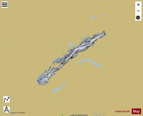
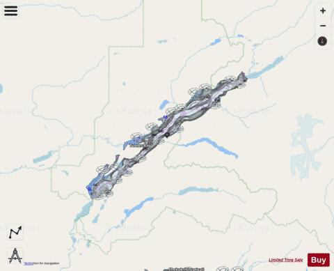
Clark, Lake Fishing Map Stats | |
| Title | Clark, Lake |
| Scale | 1:24000 |
| Counties | Lake and Peninsula |
| Nearby Cities | Port Alsworth, Nondalton, Iliamna, Newhalen, Pedro Bay, Kokhanok |
| Area * | 76889.49 acres |
| Shoreline * | 160.63 miles |
| Min Longitude | -154.79 |
| Min Latitude | 60.02 |
| Max Longitude | -153.82 |
| Max Latitude | 60.40 |
| Edition Label 1 | |
| Edition Label 2 | |
| Edition Label 3 | |
| Id | US_AK_01400425 |
| Country | US |
| Projection | Mercator |
| * some Stats may include nearby/connecting waterbodies | |
|