Grebe Lake fishing map is available as part of iBoating : USA Marine & Fishing App(now supported on multiple platforms including Android, iPhone/iPad, MacBook, and Windows(tablet and phone)/PC based chartplotter.).
With our Lake Maps App, you get all the great marine chart app features like fishing spots, along with Grebe Lake depth map. The fishing maps app include HD lake depth contours, along with advanced features found in Fish Finder / Gps Chart Plotter systems, turning your device into a Depth Finder. The Grebe Lake Navigation App provides advanced features of a Marine Chartplotter including adjusting water level offset and custom depth shading. Fishing spots and depth contours layers are available in most Lake maps. Lake navigation features include advanced instrumentation to gather wind speed direction, water temperature, water depth, and accurate GPS with AIS receivers(using NMEA over TCP/UDP). Autopilot support can be enabled during ‘Goto WayPoint’ and ‘Route Assistance’.
Now i-Boating supports Fishing Points in Grebe Lake.
Have more questions about the Nautical Chart App? Ask us.
Fishing Info for Grebe Lake
Grebe Lake is a 156 acres (0.63 km2) backcountry lake in Yellowstone National Park most noted for its population of Arctic grayling. Grebe Lake comprises the headwaters of the Gibbon River. Grebe Lake is located approximately 3.1 miles (5.0 km) north of the Norris-Canyon section of the Grand Loop Road. The trail to the lake passes through mostly level Lodgepole Pine forest and open meadows. The lake was named by J.P. Iddings, a geologist with the Arnold Hague geologic surveys. There are four backcountry campsites located on the lake.
More on Wikipedia...Popular fish species in this lake include Arctic grayling and Rainbow trout.
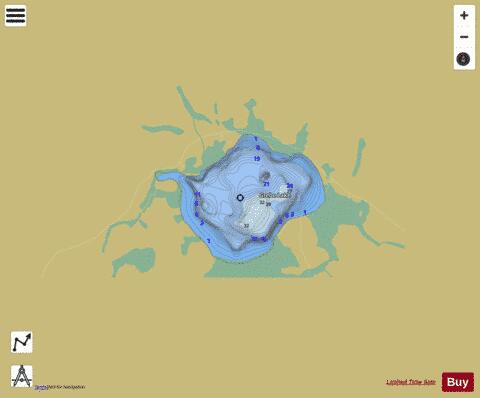
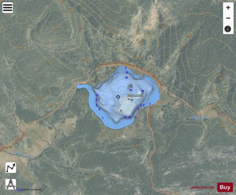
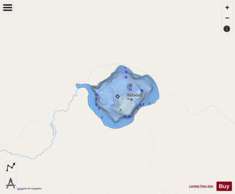
Grebe Lake Fishing Map Stats | |
| Title | Grebe Lake |
| Scale | 1:3000 |
| Counties | Park |
| Nearby Cities | Lake, Mammoth, Gardiner, Jardine, West Thumb, Corwin Springs, West Yellowstone, Miner, Chico Hot Springs, Silver Gate |
| Area * | 149.21 acres |
| Shoreline * | 2.13 miles |
| Min Longitude | -110.57 |
| Min Latitude | 44.75 |
| Max Longitude | -110.55 |
| Max Latitude | 44.76 |
| Edition Label 1 | |
| Edition Label 2 | |
| Edition Label 3 | |
| Id | US_AA_WY_grebe_wy |
| Country | US |
| Projection | Mercator |
| * some Stats may include nearby/connecting waterbodies | |
|