Dutch Hollow Lake fishing map is available as part of iBoating : USA Marine & Fishing App(now supported on multiple platforms including Android, iPhone/iPad, MacBook, and Windows(tablet and phone)/PC based chartplotter.).
With our Lake Maps App, you get all the great marine chart app features like fishing spots, along with Dutch Hollow Lake depth map. The fishing maps app include HD lake depth contours, along with advanced features found in Fish Finder / Gps Chart Plotter systems, turning your device into a Depth Finder. The Dutch Hollow Lake Navigation App provides advanced features of a Marine Chartplotter including adjusting water level offset and custom depth shading. Fishing spots and depth contours layers are available in most Lake maps. Lake navigation features include advanced instrumentation to gather wind speed direction, water temperature, water depth, and accurate GPS with AIS receivers(using NMEA over TCP/UDP). Autopilot support can be enabled during ‘Goto WayPoint’ and ‘Route Assistance’.
Now i-Boating supports Fishing Points in Dutch Hollow Lake.
Have more questions about the Nautical Chart App? Ask us.
Fishing Info for Dutch Hollow Lake
Dutch Hollow Lake is a man-made reservoir located in the Town of La Valle, (Sauk County), Wisconsin, United States. Created by developers in the 1970s by impounding the water of , it is now a public-access lake regulated by the Wisconsin Department of Natural Resources with two public-access ramps. The 40-foot (12 m) depth of the lake is maintained both by the flow from Dutch Hollow Creek and the pumping of groundwater.
More on Wikipedia...Popular fish species in this lake include Crappie, Lepomis and Walleye.
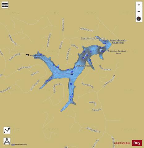
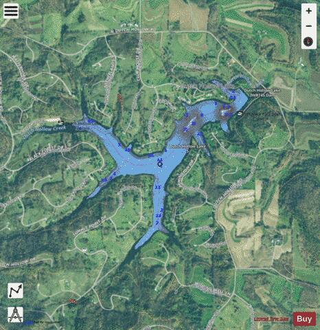
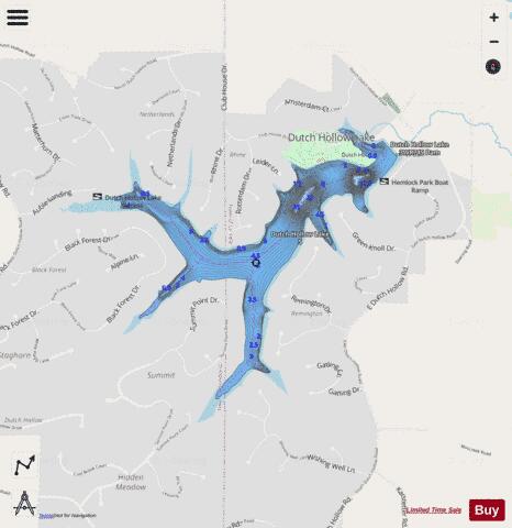
Dutch Hollow Lake Fishing Map Stats | |
| Title | Dutch Hollow Lake |
| Scale | 1:3000 |
| Counties | Sauk |
| Nearby Cities | Wonewoc, La Valle, Ironton, Cazenovia, Valton, Union Center, Lime Ridge, Hillsboro, Elroy, Loyd |
| Area * | 135.70 acres |
| Shoreline * | 5.77 miles |
| Min Longitude | -90.20 |
| Min Latitude | 43.59 |
| Max Longitude | -90.18 |
| Max Latitude | 43.61 |
| Edition Label 1 | |
| Edition Label 2 | |
| Edition Label 3 | |
| Id | US_AA_WI_dutch_hollow_lake_wi |
| Country | US |
| Projection | Mercator |
| * some Stats may include nearby/connecting waterbodies | |
|