Waterman Reservoir fishing map is available as part of iBoating : USA Marine & Fishing App(now supported on multiple platforms including Android, iPhone/iPad, MacBook, and Windows(tablet and phone)/PC based chartplotter.).
With our Lake Maps App, you get all the great marine chart app features like fishing spots, along with Waterman Reservoir depth map. The fishing maps app include HD lake depth contours, along with advanced features found in Fish Finder / Gps Chart Plotter systems, turning your device into a Depth Finder. The Waterman Reservoir Navigation App provides advanced features of a Marine Chartplotter including adjusting water level offset and custom depth shading. Fishing spots and depth contours layers are available in most Lake maps. Lake navigation features include advanced instrumentation to gather wind speed direction, water temperature, water depth, and accurate GPS with AIS receivers(using NMEA over TCP/UDP). Autopilot support can be enabled during ‘Goto WayPoint’ and ‘Route Assistance’.
Now i-Boating supports Fishing Points in Waterman Reservoir.
Have more questions about the Nautical Chart App? Ask us.
Fishing Info for Waterman Reservoir
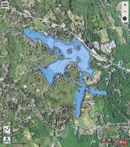
Waterman Reservoir (also known as Waterman's Reservoir) is a large lake along Putnam Pike in Glocester and Greenville in Providence County, Rhode Island. The Waterman Reservoir was created in 1838 on the site of a swamp and is 318 acres (129 ha) when full with an average depth of nine feet (2.7 m). It was named after Resolved Waterman, an early eighteenth century Greenville resident and landowner. Prior to the creation of the reservoir, the area was swampy, so a dam was constructed to create the reservoir and at the same time a causeway (now part of the Putnam Pike) was built so travelers no longer had to go around the swamp using Austin Avenue, which prior to the 1930s was known as (Old) Killingly Road.
More on Wikipedia...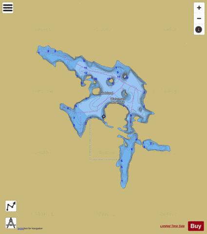
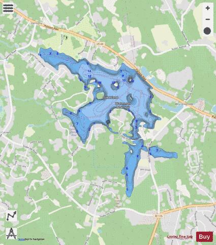
Waterman Reservoir Fishing Map Stats | |
| Title | Waterman Reservoir |
| Scale | 1:12000 |
| Counties | Providence |
| Nearby Cities | Harmony, Greenville, Smithfield, Georgiaville, Esmond, Chepachet, Centredale, Harrisville, Union Village, Pascoag |
| Area * | 261.49 acres |
| Shoreline * | 8.56 miles |
| Min Longitude | -71.60 |
| Min Latitude | 41.87 |
| Max Longitude | -71.57 |
| Max Latitude | 41.88 |
| Edition Label 1 | |
| Edition Label 2 | |
| Edition Label 3 | |
| Id | US_AA_RI_waterman_reservoir_ri |
| Country | US |
| Projection | Mercator |
| * some Stats may include nearby/connecting waterbodies | |
|