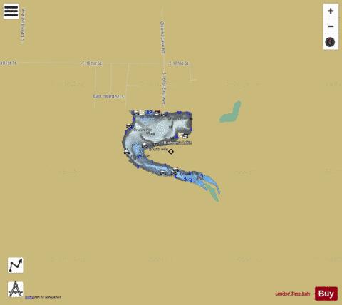
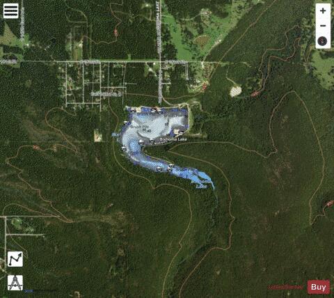
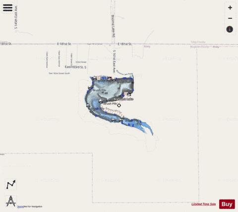
Bixhoma Lake fishing map is available as part of iBoating : USA Marine & Fishing App(now supported on multiple platforms including Android, iPhone/iPad, MacBook, and Windows(tablet and phone)/PC based chartplotter.).
With our Lake Maps App, you get all the great marine chart app features like fishing spots, along with Bixhoma Lake depth map. The fishing maps app include HD lake depth contours, along with advanced features found in Fish Finder / Gps Chart Plotter systems, turning your device into a Depth Finder. The Bixhoma Lake Navigation App provides advanced features of a Marine Chartplotter including adjusting water level offset and custom depth shading. Fishing spots and depth contours layers are available in most Lake maps. Lake navigation features include advanced instrumentation to gather wind speed direction, water temperature, water depth, and accurate GPS with AIS receivers(using NMEA over TCP/UDP). Autopilot support can be enabled during ‘Goto WayPoint’ and ‘Route Assistance’.
Now i-Boating supports Fishing Points in Bixhoma Lake.
Have more questions about the Nautical Chart App? Ask us.
Fishing Info for Bixhoma Lake
Lake Bixhoma, is a public reservoir owned and operated by the city of Bixby, Oklahoma. Lake Bixhoma has 3 miles (4.8 km) of shoreline, a surface area of 110 acres (45 ha) and a maximum depth of 50 feet (15 m). It is located on Bixhoma Lake Road about 7 miles southeast of Bixby, and 2.2 miles south of U.S. 64 and the community of Leonard, Oklahoma. Built in 1965, it is situated on Leonard Mountain at an elevation of 899 feet (274 m) above sea level, nearly 300 feet (91 m) above the elevation of Bixby (600 feet (183 m) above sea level), and was originally built to supply raw water to the city.
More on Wikipedia...Popular fish species in this lake include Crappie, Largemouth bass and Panfish.
Bixhoma Lake Fishing Map Stats | |
| Title | Bixhoma Lake |
| Scale | 1:6000 |
| Counties | Wagoner |
| Nearby Cities | Leonard, Haskell, Bixby, Coweta, Broken Arrow, Redbird, Liberty, New Tulsa, Alsuma, Winchester |
| Area * | 96.90 acres |
| Shoreline * | 3.14 miles |
| Min Longitude | -95.80 |
| Min Latitude | 35.89 |
| Max Longitude | -95.79 |
| Max Latitude | 35.90 |
| Edition Label 1 | |
| Edition Label 2 | |
| Edition Label 3 | |
| Id | US_AA_OK_bixhoma_lake_ok |
| Country | US |
| Projection | Mercator |
| * some Stats may include nearby/connecting waterbodies | |
|