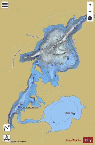
Lake Kushaqua fishing map is available as part of iBoating : USA Marine & Fishing App(now supported on multiple platforms including Android, iPhone/iPad, MacBook, and Windows(tablet and phone)/PC based chartplotter.).
With our Lake Maps App, you get all the great marine chart app features like fishing spots, along with Lake Kushaqua depth map. The fishing maps app include HD lake depth contours, along with advanced features found in Fish Finder / Gps Chart Plotter systems, turning your device into a Depth Finder. The Lake Kushaqua Navigation App provides advanced features of a Marine Chartplotter including adjusting water level offset and custom depth shading. Fishing spots and depth contours layers are available in most Lake maps. Lake navigation features include advanced instrumentation to gather wind speed direction, water temperature, water depth, and accurate GPS with AIS receivers(using NMEA over TCP/UDP). Autopilot support can be enabled during ‘Goto WayPoint’ and ‘Route Assistance’.
Now i-Boating supports Fishing Points in Lake Kushaqua.
Have more questions about the Nautical Chart App? Ask us.
Fishing Info for Lake Kushaqua
Lake Kushaqua is a 380 acres (150 ha) lake near Loon Lake and Rainbow Lake in the town of Franklin, New York state. It is on the North Branch of the Saranac River. The shoreline is state owned except for two small inholdings. The New York State Department of Environmental Conservation operates a campground on Kushaqua and nearby . It was the site of the Lake Kushaqua Hotel, built in 1893, which was one of the first hotels in the Adirondacks with electric lighting. It was accessible via the Chateaugay Railroad and the Adirondack Division of the New York Central Railroad, which passed the lake on either side. In 1901, the was built on 1800 acres bordering the lake. The rail bed of the Delaware and Hudson line runs along the eastern shore of the lake, past the Buck Pond campground, and that of the Adirondack Division of the New York Central Railroad runs along the western shore past the remaining buildings of Stony Wold: the beautiful chapel and two cottages on the lake shore. When it was built, the 1,200 acres (490 ha) sanatorium property included all of Lake Kushaqua and nearby Buck Pond, purchased in 1901 for $20,000. When the sanatorium closed in the 1950s, it was given to the White Fathers of Africa; they sold it to the state in 1970, after which the huge main building, laundry and power plant were destroyed.
More on Wikipedia...Lake Kushaqua Fishing Map Stats | |
| Title | Lake Kushaqua |
| Scale | 1:12000 |
| Counties | Franklin |
| Nearby Cities | Loon Lake, Harrietstown, Paul Smiths, Lake Clear, Saranac Lake, Lake Placid, Lyon Mountain, North Elba, Redford, Wilmington |
| Area * | 380.19 acres |
| Shoreline * | 8.53 miles |
| Min Longitude | -74.13 |
| Min Latitude | 44.50 |
| Max Longitude | -74.10 |
| Max Latitude | 44.53 |
| Edition Label 1 | |
| Edition Label 2 | |
| Edition Label 3 | |
| Id | US_AA_NY_lake_kushaqua_ny |
| Country | US |
| Projection | Mercator |
| * some Stats may include nearby/connecting waterbodies | |
|


