Farrington Lake fishing map is available as part of iBoating : USA Marine & Fishing App(now supported on multiple platforms including Android, iPhone/iPad, MacBook, and Windows(tablet and phone)/PC based chartplotter.).
With our Lake Maps App, you get all the great marine chart app features like fishing spots, along with Farrington Lake depth map. The fishing maps app include HD lake depth contours, along with advanced features found in Fish Finder / Gps Chart Plotter systems, turning your device into a Depth Finder. The Farrington Lake Navigation App provides advanced features of a Marine Chartplotter including adjusting water level offset and custom depth shading. Fishing spots and depth contours layers are available in most Lake maps. Lake navigation features include advanced instrumentation to gather wind speed direction, water temperature, water depth, and accurate GPS with AIS receivers(using NMEA over TCP/UDP). Autopilot support can be enabled during ‘Goto WayPoint’ and ‘Route Assistance’.
Now i-Boating supports Fishing Points in Farrington Lake.
Have more questions about the Nautical Chart App? Ask us.
Fishing Info for Farrington Lake
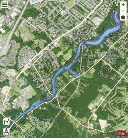
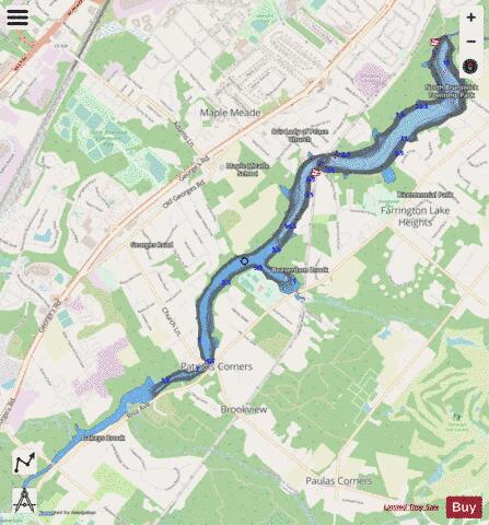
Farrington Lake is a scenic freshwater reservoir in Middlesex County, New Jersey near Milltown, New Jersey. Created by a dam on the Lawrence Brook, a tributary of the Raritan River, the lake is in fact a widened section of the Lawrence Brook. Its main tributaries are the Ireland Brook, the Beaverdam Brook, and the Oakeys Brook. The lake is named after Edward Farrington, mayor of New Brunswick, New Jersey, in 1915–1918, who envisioned the construction of the dam to supply water to his city. Mayor Farrington died while in office, in 1918. The lake is bordered by East Brunswick, North Brunswick and South Brunswick. It covers about 1.17 km² (290 acres) and has a mean depth of 2 meters (6 ft) with a maximum depth of 4 meters (12 ft). The lake is accessible from a boat ramp; the only powered boats allowed are those with an electric motor. Fish species in the lake include Chain Pickerel, Channel Catfish, Largemouth Bass, Northern Pike, Crappie, Brown Trout, Yellow Perch and Rainbow Trout.
More on Wikipedia...Popular fish species in this lake include Crappie.
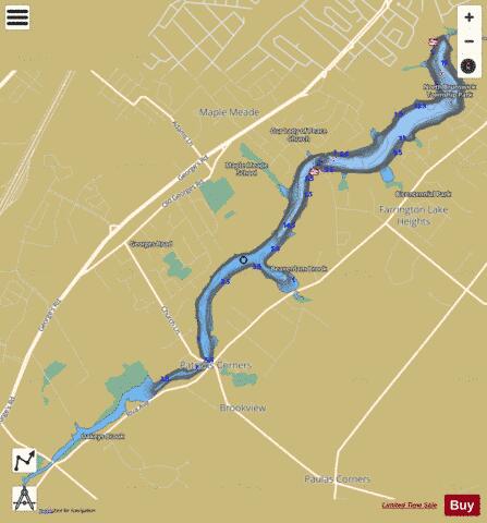
Farrington Lake Fishing Map Stats | |
| Title | Farrington Lake |
| Scale | 1:6000 |
| Counties | Middlesex |
| Nearby Cities | Milltown, North Brunswick, Deans, New Brunswick, East Brunswick, Dayton, Highland Park, Franklin Park, Somerset, Monmouth Junction |
| Area * | 221.34 acres |
| Shoreline * | 9.85 miles |
| Min Longitude | -74.50 |
| Min Latitude | 40.41 |
| Max Longitude | -74.45 |
| Max Latitude | 40.45 |
| Edition Label 1 | |
| Edition Label 2 | |
| Edition Label 3 | |
| Id | US_AA_NJ_farrington_lake__nj |
| Country | US |
| Projection | Mercator |
| * some Stats may include nearby/connecting waterbodies | |
|