Lake Sakakawea fishing map is available as part of iBoating : USA Marine & Fishing App(now supported on multiple platforms including Android, iPhone/iPad, MacBook, and Windows(tablet and phone)/PC based chartplotter.).
With our Lake Maps App, you get all the great marine chart app features like fishing spots, along with Lake Sakakawea depth map. The fishing maps app include HD lake depth contours, along with advanced features found in Fish Finder / Gps Chart Plotter systems, turning your device into a Depth Finder. The Lake Sakakawea Navigation App provides advanced features of a Marine Chartplotter including adjusting water level offset and custom depth shading. Fishing spots and depth contours layers are available in most Lake maps. Lake navigation features include advanced instrumentation to gather wind speed direction, water temperature, water depth, and accurate GPS with AIS receivers(using NMEA over TCP/UDP). Autopilot support can be enabled during ‘Goto WayPoint’ and ‘Route Assistance’.
Now i-Boating supports Fishing Points in Lake Sakakawea.
Have more questions about the Nautical Chart App? Ask us.
Fishing Info for Lake Sakakawea
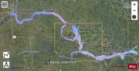
Lake Sakakawea is a large reservoir in the north central United States, impounded in 1953 by Garrison Dam, a U.S. Army Corps of Engineers dam located in the Missouri River basin in central North Dakota. Named for the Shoshone-Hidatsa woman Sakakawea (who accompanied the Lewis and Clark Expedition), it is the largest man-made lake located entirely within North Dakota, the second largest in the United States by area after Lake Oahe, and the third largest in the United States by volume, after Lake Mead and Lake Powell. The lake is located about fifty miles (80 km) from the state capital of Bismarck; the distance by the Missouri River is about 75 miles (120 km). The lake's width averages between 2–3 miles (3–5 km), with a maximum of 14 miles (23 km) at Van Hook Arm. Lake Sakakawea marks the maximum southwest extent of glaciation during the ice age. The lake is located within the counties of: Dunn, McKenzie, McLean, Mercer, Mountrail, and Williams.
More on Wikipedia...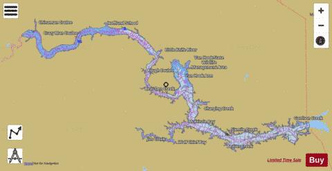
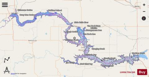
Lake Sakakawea Fishing Map Stats | |
| Title | Lake Sakakawea |
| Scale | 1:24000 |
| Counties | Dunn, McKenzie, McLean, Mercer, Mountrail, Williams |
| Nearby Cities | Williston, Pick City, Riverdale, New Town, Garrison, Coleharbor, Mandaree, Raub, White Shield, Trenton |
| Area * | 350520.07 acres |
| Shoreline * | 1396.52 miles |
| Min Longitude | -103.72 |
| Min Latitude | 47.45 |
| Max Longitude | -101.25 |
| Max Latitude | 48.21 |
| Edition Label 1 | |
| Edition Label 2 | |
| Edition Label 3 | |
| Id | US_AA_ND_sakakawea_lake_nd |
| Country | US |
| Projection | Mercator |
| * some Stats may include nearby/connecting waterbodies | |
|