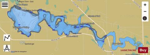
Lake ,Allegan fishing map is available as part of iBoating : USA Marine & Fishing App(now supported on multiple platforms including Android, iPhone/iPad, MacBook, and Windows(tablet and phone)/PC based chartplotter.).
With our Lake Maps App, you get all the great marine chart app features like fishing spots, along with Lake ,Allegan depth map. The fishing maps app include HD lake depth contours, along with advanced features found in Fish Finder / Gps Chart Plotter systems, turning your device into a Depth Finder. The Lake ,Allegan Navigation App provides advanced features of a Marine Chartplotter including adjusting water level offset and custom depth shading. Fishing spots and depth contours layers are available in most Lake maps. Lake navigation features include advanced instrumentation to gather wind speed direction, water temperature, water depth, and accurate GPS with AIS receivers(using NMEA over TCP/UDP). Autopilot support can be enabled during ‘Goto WayPoint’ and ‘Route Assistance’.
Now i-Boating supports Fishing Points in Lake ,Allegan.
Have more questions about the Nautical Chart App? Ask us.
Fishing Info for Lake ,Allegan
Lake Allegan is a man-made lake located in Valley Township just outside the city of Allegan in the U.S. state of Michigan (Allegan County). The water is safe for swimming and boating. The lake has a large surface area of almost 1,600 acres (2.5 mi², 6.475 km²). Salmon runs occur on the western side of Lake Allegan's Calkins Bridge dam which leads to Lake Michigan via the Kalamazoo River. Lake Allegan is adjacent to the 50,000-acre Allegan Forest. Geese, ducks, kingfishers, eagles and great blue herons frequent the lake. The Allegan Lake Overlook is one of the best places to view the lake located on Monroe Road, two and one half miles from M-89. There is a DNR access point and a boat launch located at Echo Point on Monroe Road near 42nd Street. On the west shoreline of Lake Allegan, there still exists the building foundations of a P.O.W. camp that housed German prisoners during World War II. This camp, which is part of the Allegan State Game Area, was in use until the end of the war. The prisoners at the camp thought Lake Allegan was Lake Michigan and that they could escape by swimming to Chicago. Lake Allegan's water levels are constant and predictable due to Calkins Bridge Dam. The Kalamazoo River flows into Lake Allegan to Calkins and then out to Lake Michigan near Saugatuck. Calkins Bridge Dam provides electricity for the area and recreational opportunities. In the spring and fall, when the fish are spawning, the Calkins Bridge Dam is a favorite spot for fishermen. The Calkins Bridge Dam is owned and operated by Consumers Energy Company and is also referred to as Allegan Hydroelectric Plant. Lake Allegan
More on Wikipedia...Lake ,Allegan Fishing Map Stats | |
| Title | Lake ,Allegan |
| Scale | 1:12000 |
| Includes Data from Fish Atlas | Yes |
| Counties | Allegan |
| Nearby Cities | Allegan, Hopkins, Hamilton, Fennville, Bloomingdale, Otsego, Gobles, Grand Junction, Martin, Plainwell |
| Area * | 1699.84 acres |
| Shoreline * | 22.15 miles |
| Min Longitude | -85.96 |
| Min Latitude | 42.54 |
| Max Longitude | -85.85 |
| Max Latitude | 42.56 |
| Edition Label 1 | |
| Edition Label 2 | |
| Edition Label 3 | |
| Id | US_AA_MI_lake_allegan_mi |
| Country | US |
| Projection | Mercator |
| * some Stats may include nearby/connecting waterbodies | |
|


