Granby Lake / Arapaho Bay fishing map is available as part of iBoating : USA Marine & Fishing App(now supported on multiple platforms including Android, iPhone/iPad, MacBook, and Windows(tablet and phone)/PC based chartplotter.).
With our Lake Maps App, you get all the great marine chart app features like fishing spots, along with Granby Lake / Arapaho Bay depth map. The fishing maps app include HD lake depth contours, along with advanced features found in Fish Finder / Gps Chart Plotter systems, turning your device into a Depth Finder. The Granby Lake / Arapaho Bay Navigation App provides advanced features of a Marine Chartplotter including adjusting water level offset and custom depth shading. Fishing spots and depth contours layers are available in most Lake maps. Lake navigation features include advanced instrumentation to gather wind speed direction, water temperature, water depth, and accurate GPS with AIS receivers(using NMEA over TCP/UDP). Autopilot support can be enabled during ‘Goto WayPoint’ and ‘Route Assistance’.
Now i-Boating supports Fishing Points in Granby Lake / Arapaho Bay.
Have more questions about the Nautical Chart App? Ask us.
Fishing Info for Granby Lake / Arapaho Bay
Lake Granby is the third largest body of water in Colorado. It was created by the erection of Granby Dam, completed in 1950, as part of the Bureau of Reclamation's Colorado-Big Thompson Project. Water from Lake Granby is pumped via the Farr Pump plant though a pipeline that empties into a canal connected to Shadow Mountain Reservoir. The Bureau of Reclamation owns Farr Pump plant while Northern Water operates it. On its own, Lake Granby contains approximately 40 miles (64 km) of shoreline. The lake is popular with anglers and is continually stocked with rainbow trout and kokanee salmon. The Lake is also home to the Lake Granby Yacht Club. At 8,280 feet (2,520 m), LGYC is one of the highest-elevation yacht clubs in the world, slightly beating out Grand Lake Yacht Club on nearby Grand Lake.
More on Wikipedia...Popular fish species in this lake include Rainbow trout.
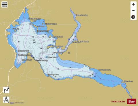
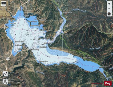
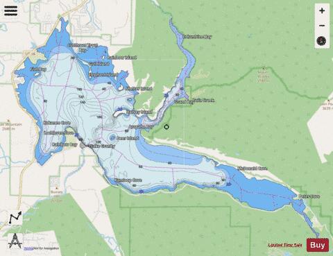
Granby Lake / Arapaho Bay Fishing Map Stats | |
| Title | Granby Lake / Arapaho Bay |
| Scale | 1:24000 |
| Counties | Grand |
| Nearby Cities | Grand Lake, Granby, Tabernash, Fraser, Winter Park, Hot Sulphur Springs, East Portal, Allenspark, Ward, Eldora |
| Area * | 6984.27 acres |
| Shoreline * | 42.23 miles |
| Min Longitude | -105.90 |
| Min Latitude | 40.11 |
| Max Longitude | -105.76 |
| Max Latitude | 40.19 |
| Edition Label 1 | |
| Edition Label 2 | |
| Edition Label 3 | |
| Id | US_AA_CO_00202536 |
| Country | US |
| Projection | Mercator |
| * some Stats may include nearby/connecting waterbodies | |
|