Dillon Reservoir fishing map is available as part of iBoating : USA Marine & Fishing App(now supported on multiple platforms including Android, iPhone/iPad, MacBook, and Windows(tablet and phone)/PC based chartplotter.).
With our Lake Maps App, you get all the great marine chart app features like fishing spots, along with Dillon Reservoir depth map. The fishing maps app include HD lake depth contours, along with advanced features found in Fish Finder / Gps Chart Plotter systems, turning your device into a Depth Finder. The Dillon Reservoir Navigation App provides advanced features of a Marine Chartplotter including adjusting water level offset and custom depth shading. Fishing spots and depth contours layers are available in most Lake maps. Lake navigation features include advanced instrumentation to gather wind speed direction, water temperature, water depth, and accurate GPS with AIS receivers(using NMEA over TCP/UDP). Autopilot support can be enabled during ‘Goto WayPoint’ and ‘Route Assistance’.
Now i-Boating supports Fishing Points in Dillon Reservoir.
Have more questions about the Nautical Chart App? Ask us.
Fishing Info for Dillon Reservoir
Dillon Reservoir, sometimes referred to as Lake Dillon, is a large fresh water reservoir located in Summit County, Colorado, United States, south of I-70 and bordered by the towns of Frisco, Silverthorne, and Dillon. It is a reservoir for the city of Denver, and its waters are under the control of Denver Water. Popular ski areas are close to the reservoir, including Copper Mountain, Keystone, Arapahoe Basin, and Breckenridge.
More on Wikipedia...Popular fish species in this lake include Rainbow trout.
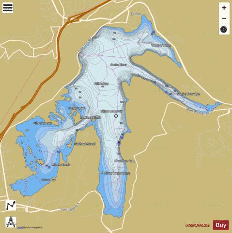
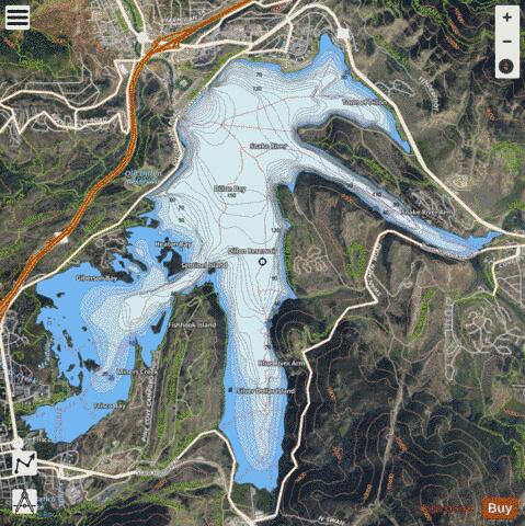
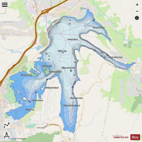
Dillon Reservoir Fishing Map Stats | |
| Title | Dillon Reservoir |
| Sailing Clubs in this Chart region | |
| Dillon Yacht Club | |
| Scale | 1:24000 |
| Counties | Summit |
| Nearby Cities | Dillon, Frisco, Silverthorne, Keystone, Breckenridge, Blue River, Montezuma, Kokomo, Climax, Red Cliff |
| Area * | 3218.71 acres |
| Shoreline * | 32.87 miles |
| Min Longitude | -106.09 |
| Min Latitude | 39.57 |
| Max Longitude | -106.01 |
| Max Latitude | 39.63 |
| Edition Label 1 | |
| Edition Label 2 | |
| Edition Label 3 | |
| Id | US_AA_CO_00202344 |
| Country | US |
| Projection | Mercator |
| * some Stats may include nearby/connecting waterbodies | |
|