Caples Lake fishing map is available as part of iBoating : USA Marine & Fishing App(now supported on multiple platforms including Android, iPhone/iPad, MacBook, and Windows(tablet and phone)/PC based chartplotter.).
With our Lake Maps App, you get all the great marine chart app features like fishing spots, along with Caples Lake depth map. The fishing maps app include HD lake depth contours, along with advanced features found in Fish Finder / Gps Chart Plotter systems, turning your device into a Depth Finder. The Caples Lake Navigation App provides advanced features of a Marine Chartplotter including adjusting water level offset and custom depth shading. Fishing spots and depth contours layers are available in most Lake maps. Lake navigation features include advanced instrumentation to gather wind speed direction, water temperature, water depth, and accurate GPS with AIS receivers(using NMEA over TCP/UDP). Autopilot support can be enabled during ‘Goto WayPoint’ and ‘Route Assistance’.
Now i-Boating supports Fishing Points in Caples Lake.
Have more questions about the Nautical Chart App? Ask us.
Fishing Info for Caples Lake
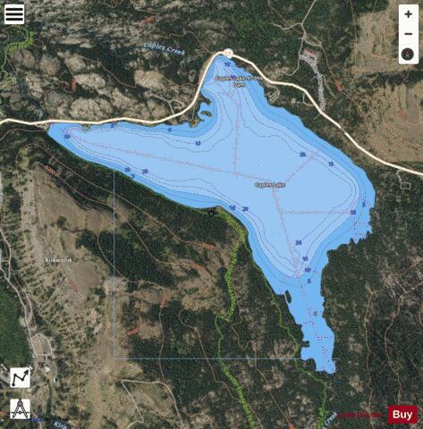
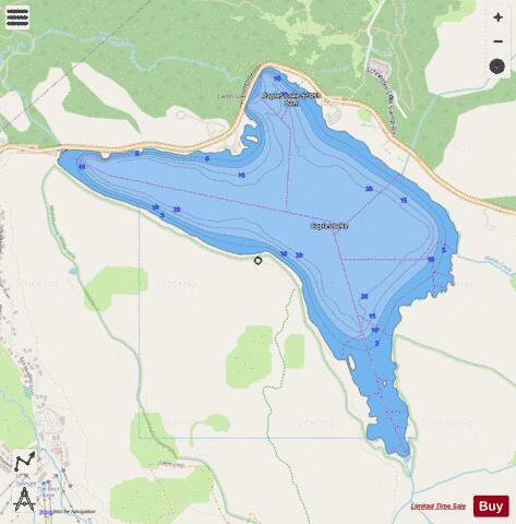
Caples lake is a reservoir that is located near Kirkwood, California along highway 88 (also called Carson pass). The lake was used as a halting place for wagon travelers who were trekking the historic Mormon Emigrant trail during the Gold Rush. The lake has been used by many different groups of people including Native Americans, 49ers, and resort owners so it is known by a few different names. The variant names are clear lake, summit lake, and twin lakes. Currently, Caples lake is a reservoir being used for water and recreation. Woods creek and Emigrant creek both flow into Caples lake which drains into Caples creek. Caples creek meets up with the South Fork of the American River. Caples lake is owned by the El Dorado Irrigation District (EID) who is using it as part of the hydroelectric project 184 system.
More on Wikipedia...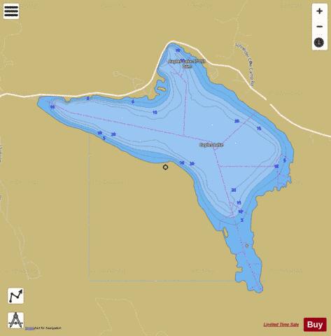
Caples Lake Fishing Map Stats | |
| Title | Caples Lake |
| Scale | 1:12000 |
| Counties | Alpine |
| Nearby Cities | Kirkwood, Bear Valley, Woodfords, South Lake Tahoe, Kyburz, Markleeville, Stateline, Zephyr Cove, Skyland, Meeks Bay |
| Area * | 605.72 acres |
| Shoreline * | 6.70 miles |
| Min Longitude | -120.07 |
| Min Latitude | 38.68 |
| Max Longitude | -120.03 |
| Max Latitude | 38.71 |
| Edition Label 1 | |
| Edition Label 2 | |
| Edition Label 3 | |
| Id | US_AA_CA_caples_lake_califronia |
| Country | US |
| Projection | Mercator |
| * some Stats may include nearby/connecting waterbodies | |
|