Trail Lakes Lake fishing map is available as part of iBoating : USA Marine & Fishing App(now supported on multiple platforms including Android, iPhone/iPad, MacBook, and Windows(tablet and phone)/PC based chartplotter.).
With our Lake Maps App, you get all the great marine chart app features like fishing spots, along with Trail Lakes Lake depth map. The fishing maps app include HD lake depth contours, along with advanced features found in Fish Finder / Gps Chart Plotter systems, turning your device into a Depth Finder. The Trail Lakes Lake Navigation App provides advanced features of a Marine Chartplotter including adjusting water level offset and custom depth shading. Fishing spots and depth contours layers are available in most Lake maps. Lake navigation features include advanced instrumentation to gather wind speed direction, water temperature, water depth, and accurate GPS with AIS receivers(using NMEA over TCP/UDP). Autopilot support can be enabled during ‘Goto WayPoint’ and ‘Route Assistance’.
Now i-Boating supports Fishing Points in Trail Lakes Lake.
Have more questions about the Nautical Chart App? Ask us.
Fishing Info for Trail Lakes Lake
The Trail Lakes are two lakes on the lower Kenai Peninsula, Alaska. The lakes are near the town of Moose Pass and adjacent to the Seward Highway. They are the home of a large salmon hatchery owned by the state of Alaska and operated by the Cook Inlet Aquaculture Association. The fish hatched at this facility are released into streams and lakes at various points on the peninsula, and are also the source of the salmon runs at the "fishing hole" on the Homer Spit. The hatchery was at the center of a prolonged legal battle between the Wilderness Society and the U.S. Fish and Wildlife Service. The society claimed that the hatchery was conducting commercial activity in a wilderness area, and such activity is illegal under the Wilderness Act.
More on Wikipedia...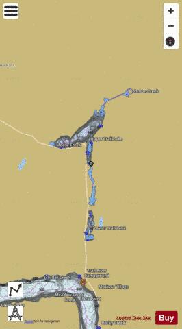
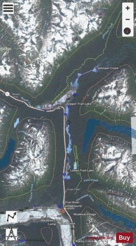
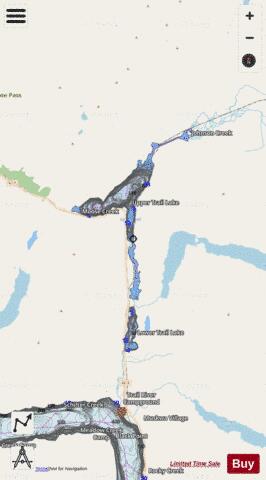
Trail Lakes Lake Fishing Map Stats | |
| Title | Trail Lakes Lake |
| Scale | 1:12000 |
| Counties | Kenai Peninsula |
| Nearby Cities | Moose Pass, Silvertip, Seward, Cooper Landing, Girdwood, Hope, Whittier, Nunaka Valley, Eagle River, Spenard |
| Area * | 1869.70 acres |
| Shoreline * | 25.82 miles |
| Min Longitude | -149.42 |
| Min Latitude | 60.44 |
| Max Longitude | -149.30 |
| Max Latitude | 60.54 |
| Edition Label 1 | |
| Edition Label 2 | |
| Edition Label 3 | |
| Id | US_AA_AK_trail_lakes__ak |
| Country | US |
| Projection | Mercator |
| * some Stats may include nearby/connecting waterbodies | |
|